

Belgien-Frühjahrsradtour 2016 - 1. Tag (neu)
A cycling route starting in Trois-Ponts, Wallonia, Belgium.
Overview
About this route
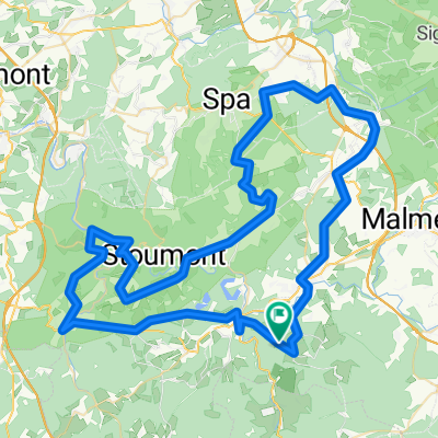
Start and finish in Petit Coo. 60 km loop over the following famous climbs
Thier de Coo Cote de Chodes Signal de Botrange (highest point in Belgium) Cote de la Ferme Libert (up to 20%) Cote de Rivage- -:--
- Duration
- 59.5 km
- Distance
- 861 m
- Ascent
- 838 m
- Descent
- ---
- Avg. speed
- ---
- Max. altitude
Route quality
Waytypes & surfaces along the route
Waytypes
Quiet road
16.7 km
(28 %)
Cycleway
11.9 km
(20 %)
Surfaces
Paved
39.9 km
(67 %)
Unpaved
1.2 km
(2 %)
Asphalt
38.1 km
(64 %)
Paved (undefined)
1.8 km
(3 %)
Continue with Bikemap
Use, edit, or download this cycling route
You would like to ride Belgien-Frühjahrsradtour 2016 - 1. Tag (neu) or customize it for your own trip? Here is what you can do with this Bikemap route:
Free features
- Save this route as favorite or in collections
- Copy & plan your own version of this route
- Sync your route with Garmin or Wahoo
Premium features
Free trial for 3 days, or one-time payment. More about Bikemap Premium.
- Navigate this route on iOS & Android
- Export a GPX / KML file of this route
- Create your custom printout (try it for free)
- Download this route for offline navigation
Discover more Premium features.
Get Bikemap PremiumFrom our community
Other popular routes starting in Trois-Ponts
 B-Ardennen-80 1500
- Distance
- 85.6 km
- Ascent
- 1,322 m
- Descent
- 1,321 m
- Location
- Trois-Ponts, Wallonia, Belgium
 Belgien-Frühjahrstour (Abschlusstour)
- Distance
- 53.8 km
- Ascent
- 1,112 m
- Descent
- 1,093 m
- Location
- Trois-Ponts, Wallonia, Belgium
 Coo - Fischbach
- Distance
- 110.6 km
- Ascent
- 758 m
- Descent
- 719 m
- Location
- Trois-Ponts, Wallonia, Belgium
 02-troispont2009
- Distance
- 76.6 km
- Ascent
- 1,299 m
- Descent
- 1,327 m
- Location
- Trois-Ponts, Wallonia, Belgium
 De acht van Trois ponts
- Distance
- 83.7 km
- Ascent
- 1,291 m
- Descent
- 1,290 m
- Location
- Trois-Ponts, Wallonia, Belgium
 Promenade des points de vue
- Distance
- 5.6 km
- Ascent
- 336 m
- Descent
- 336 m
- Location
- Trois-Ponts, Wallonia, Belgium
 Belgien-Frühjahrstour 2016 - 3.Tag
- Distance
- 86.2 km
- Ascent
- 1,244 m
- Descent
- 1,232 m
- Location
- Trois-Ponts, Wallonia, Belgium
 Zaterdagroute chouffesweekend 2021
- Distance
- 104 km
- Ascent
- 1,766 m
- Descent
- 1,766 m
- Location
- Trois-Ponts, Wallonia, Belgium
Open it in the app