

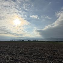
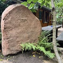
Von Deidesheim zum Lambertskreuz auf Trails
A cycling route starting in Deidesheim, Rhineland-Palatinate, Germany.
Overview
About this route
Beautiful singletracks uphill and downhill
- -:--
- Duration
- 21 km
- Distance
- 781 m
- Ascent
- 426 m
- Descent
- ---
- Avg. speed
- ---
- Max. altitude
Continue with Bikemap
Use, edit, or download this cycling route
You would like to ride Von Deidesheim zum Lambertskreuz auf Trails or customize it for your own trip? Here is what you can do with this Bikemap route:
Free features
- Save this route as favorite or in collections
- Copy & plan your own version of this route
- Sync your route with Garmin or Wahoo
Premium features
Free trial for 3 days, or one-time payment. More about Bikemap Premium.
- Navigate this route on iOS & Android
- Export a GPX / KML file of this route
- Create your custom printout (try it for free)
- Download this route for offline navigation
Discover more Premium features.
Get Bikemap PremiumFrom our community
Other popular routes starting in Deidesheim
 Prinz-Rupprecht-Straße, Deidesheim nach Gerhart-Hauptmann-Straße, Haßloch
- Distance
- 8.8 km
- Ascent
- 23 m
- Descent
- 32 m
- Location
- Deidesheim, Rhineland-Palatinate, Germany
 tour 1 deidesheim
- Distance
- 38.5 km
- Ascent
- 498 m
- Descent
- 479 m
- Location
- Deidesheim, Rhineland-Palatinate, Germany
 RLP14: Deidesheim - Neuburg a.Rhein 84km 570hm
- Distance
- 89.2 km
- Ascent
- 408 m
- Descent
- 415 m
- Location
- Deidesheim, Rhineland-Palatinate, Germany
 Von Deidesheim zum Lambertskreuz auf Trails
- Distance
- 21 km
- Ascent
- 781 m
- Descent
- 426 m
- Location
- Deidesheim, Rhineland-Palatinate, Germany
 Deidesheimer RTF 2019 des RV Edelweiss 1924 Deidesheim e.V. - 48 km Strecke
- Distance
- 51.4 km
- Ascent
- 989 m
- Descent
- 959 m
- Location
- Deidesheim, Rhineland-Palatinate, Germany
 Deidesheim - Kleine Tour
- Distance
- 12.2 km
- Ascent
- 396 m
- Descent
- 396 m
- Location
- Deidesheim, Rhineland-Palatinate, Germany
 Deidesheimer RTF 2019 des RV Edelweiss 1924 Deidesheim e.V. - 81 km Strecke
- Distance
- 85.6 km
- Ascent
- 1,317 m
- Descent
- 1,262 m
- Location
- Deidesheim, Rhineland-Palatinate, Germany
 Mühltalstraße, Deidesheim nach Marktplatz, Deidesheim
- Distance
- 2.8 km
- Ascent
- 53 m
- Descent
- 139 m
- Location
- Deidesheim, Rhineland-Palatinate, Germany
Open it in the app