Congleton - Cloud - Marton - Goostrey - Congleton
A cycling route starting in Congleton, England, United Kingdom.
Overview
About this route
Out from the Congo, up the cloud and then on to Jodrell Bank via Gawsworth, returning to Congleton through Swettenham.
 Uses a small section (approx 2 miles) of unpaved (gravel) roads.- -:--
- Duration
- 52.8 km
- Distance
- 250 m
- Ascent
- 250 m
- Descent
- ---
- Avg. speed
- ---
- Avg. speed
Route quality
Waytypes & surfaces along the route
Waytypes
Quiet road
40.3 km
(76 %)
Road
4 km
(8 %)
Surfaces
Paved
37.5 km
(71 %)
Unpaved
1.7 km
(3 %)
Asphalt
36.2 km
(69 %)
Gravel
1.5 km
(3 %)
Continue with Bikemap
Use, edit, or download this cycling route
You would like to ride Congleton - Cloud - Marton - Goostrey - Congleton or customize it for your own trip? Here is what you can do with this Bikemap route:
Free features
- Save this route as favorite or in collections
- Copy & plan your own version of this route
- Sync your route with Garmin or Wahoo
Premium features
Free trial for 3 days, or one-time payment. More about Bikemap Premium.
- Navigate this route on iOS & Android
- Export a GPX / KML file of this route
- Create your custom printout (try it for free)
- Download this route for offline navigation
Discover more Premium features.
Get Bikemap PremiumFrom our community
Other popular routes starting in Congleton
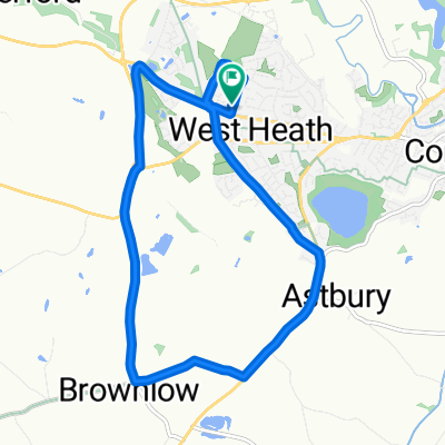
- 5 Delamere Road, Congleton to 5 Delamere Road, Congleton
- Distance
- 9.2 km
- Ascent
- 47 m
- Descent
- 48 m
- Location
- Congleton, England, United Kingdom
- Congleton - Holmes Chapel Via Brereton
- Distance
- 36.2 km
- Ascent
- 156 m
- Descent
- 156 m
- Location
- Congleton, England, United Kingdom
- The Oaks, Newcastle Road, Congleton to West Heath Shopping Centre, Holmes Chapel Road, Congleton
- Distance
- 91.2 km
- Ascent
- 9 m
- Descent
- 12 m
- Location
- Congleton, England, United Kingdom
- Congleton quick 16 ish miler
- Distance
- 27.9 km
- Ascent
- 109 m
- Descent
- 112 m
- Location
- Congleton, England, United Kingdom
- Congleton
- Distance
- 8.7 km
- Ascent
- 68 m
- Descent
- 68 m
- Location
- Congleton, England, United Kingdom
- Paul's Route to work
- Distance
- 19.3 km
- Ascent
- 191 m
- Descent
- 172 m
- Location
- Congleton, England, United Kingdom
- Congleton to Burton Terrace 33
- Distance
- 66.9 km
- Ascent
- 1,302 m
- Descent
- 1,357 m
- Location
- Congleton, England, United Kingdom
- Congleton - Alderley Edge - Knutsford - Kingsmead - Congleton
- Distance
- 93.2 km
- Ascent
- 250 m
- Descent
- 250 m
- Location
- Congleton, England, United Kingdom
Open it in the app