

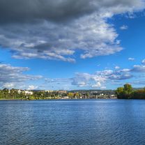
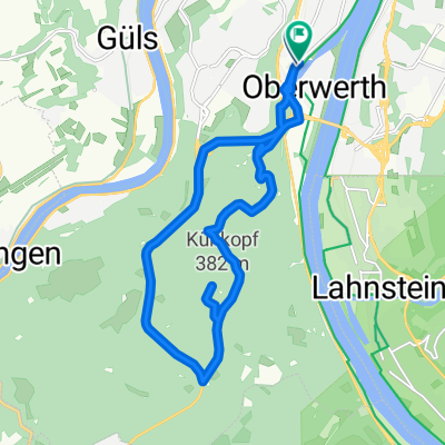
Koblenz-Wied-Sieg-WW-Sayntal-Koblenz
A cycling route starting in Koblenz, Rhineland-Palatinate, Germany.
Overview
About this route
Sehr lange Rennrad-Runde mit vielen Höhenmetern.
- -:--
- Duration
- 273.8 km
- Distance
- 1,314 m
- Ascent
- 1,314 m
- Descent
- ---
- Avg. speed
- ---
- Max. altitude

Continue with Bikemap
Use, edit, or download this cycling route
You would like to ride Koblenz-Wied-Sieg-WW-Sayntal-Koblenz or customize it for your own trip? Here is what you can do with this Bikemap route:
Free features
- Save this route as favorite or in collections
- Copy & plan your own version of this route
- Split it into stages to create a multi-day tour
- Sync your route with Garmin or Wahoo
Premium features
Free trial for 3 days, or one-time payment. More about Bikemap Premium.
- Navigate this route on iOS & Android
- Export a GPX / KML file of this route
- Create your custom printout (try it for free)
- Download this route for offline navigation
Discover more Premium features.
Get Bikemap PremiumFrom our community
Other popular routes starting in Koblenz
 mit dem Radel entlang der Mosel über Winningen nach Kobern-Gondorf
- Distance
- 36.2 km
- Ascent
- 104 m
- Descent
- 114 m
- Location
- Koblenz, Rhineland-Palatinate, Germany
 moseltour trier - koblenz
- Distance
- 205.6 km
- Ascent
- 554 m
- Descent
- 483 m
- Location
- Koblenz, Rhineland-Palatinate, Germany
 Ausflug Koblenz-Winningen und zurück, 22km
- Distance
- 21.5 km
- Ascent
- 88 m
- Descent
- 90 m
- Location
- Koblenz, Rhineland-Palatinate, Germany
 Winter
- Distance
- 15.5 km
- Ascent
- 360 m
- Descent
- 360 m
- Location
- Koblenz, Rhineland-Palatinate, Germany
 Koblenz - Bad Ems
- Distance
- 16.1 km
- Ascent
- 148 m
- Descent
- 139 m
- Location
- Koblenz, Rhineland-Palatinate, Germany
 Koblenz - Cochem
- Distance
- 50.6 km
- Ascent
- 222 m
- Descent
- 209 m
- Location
- Koblenz, Rhineland-Palatinate, Germany
 Eisenarsch-Tour 2009 (Vorschlag)
- Distance
- 174.5 km
- Ascent
- 424 m
- Descent
- 353 m
- Location
- Koblenz, Rhineland-Palatinate, Germany
 RTF "Moselkarussel" 113km
- Distance
- 113.9 km
- Ascent
- 1,208 m
- Descent
- 1,168 m
- Location
- Koblenz, Rhineland-Palatinate, Germany
Open it in the app