

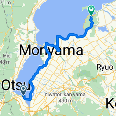
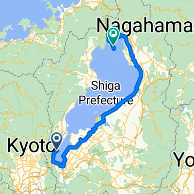
2016Tour-Otsu
A cycling route starting in Ōtsu, Shiga Prefecture, Japan.
Overview
About this route
Otsu to Kyoto
- -:--
- Duration
- 12.2 km
- Distance
- 232 m
- Ascent
- 303 m
- Descent
- ---
- Avg. speed
- ---
- Max. altitude

Continue with Bikemap
Use, edit, or download this cycling route
You would like to ride 2016Tour-Otsu or customize it for your own trip? Here is what you can do with this Bikemap route:
Free features
- Save this route as favorite or in collections
- Copy & plan your own version of this route
- Sync your route with Garmin or Wahoo
Premium features
Free trial for 3 days, or one-time payment. More about Bikemap Premium.
- Navigate this route on iOS & Android
- Export a GPX / KML file of this route
- Create your custom printout (try it for free)
- Download this route for offline navigation
Discover more Premium features.
Get Bikemap PremiumFrom our community
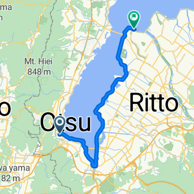
Other popular routes starting in Ōtsu
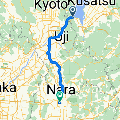 Ōtsu - Nara
- Distance
- 54.5 km
- Ascent
- 318 m
- Descent
- 367 m
- Location
- Ōtsu, Shiga Prefecture, Japan
 2016Tour-Kyoto
- Distance
- 59.5 km
- Ascent
- 182 m
- Descent
- 160 m
- Location
- Ōtsu, Shiga Prefecture, Japan
 Otsu-Omihachiman
- Distance
- 46.6 km
- Ascent
- 256 m
- Descent
- 249 m
- Location
- Ōtsu, Shiga Prefecture, Japan
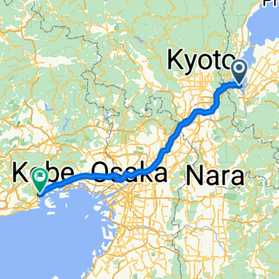 Nionohama 4-Chōme, Otsu to Kitanagasadori 5-Chōme, Kobe
- Distance
- 98.9 km
- Ascent
- 737 m
- Descent
- 803 m
- Location
- Ōtsu, Shiga Prefecture, Japan
 琵琶湖环游
琵琶湖环游- Distance
- 206.3 km
- Ascent
- 853 m
- Descent
- 882 m
- Location
- Ōtsu, Shiga Prefecture, Japan
 环琵琶湖第一天
- Distance
- 125.9 km
- Ascent
- 1,243 m
- Descent
- 1,088 m
- Location
- Ōtsu, Shiga Prefecture, Japan
 Biwako Day 4: To Lake Biwa Marriott Hotel
- Distance
- 30.7 km
- Ascent
- 72 m
- Descent
- 80 m
- Location
- Ōtsu, Shiga Prefecture, Japan
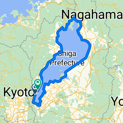
 Biwa circuit
- Distance
- 199 km
- Ascent
- 405 m
- Descent
- 404 m
- Location
- Ōtsu, Shiga Prefecture, Japan
Open it in the app