

110 km Sparkassen Panorama- RADtour
A cycling route starting in Sebnitz, Saxony, Germany.
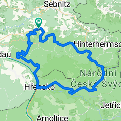
Overview
About this route
Sparkassen PanoramaTour - jedes Jahr immer im August
Eine Radstrecke mit ganz vielen tollen Eindrücken auf, über und in die Sächsische Schweiz. Alle Radler erhalten ein kostenfreies Frühstück, eine Radstreckenkarte mit ausführlicher Streckenbeschreibung (radeln nach einer von uns vorgegebenen Radtourenstrecke), Verpflegungspunkt in Bad Schandau, warmes Essen in Bahra, Medaille, Urkunde und Erdinger-Freibier im Ziel.(cloned from route 2579118)
- -:--
- Duration
- 101.1 km
- Distance
- 1,097 m
- Ascent
- 1,097 m
- Descent
- ---
- Avg. speed
- ---
- Max. altitude
Route quality
Waytypes & surfaces along the route
Waytypes
Busy road
58.9 km
(58 %)
Road
24.4 km
(24 %)
Surfaces
Paved
97 km
(96 %)
Unpaved
0.1 km
(<1 %)
Asphalt
94.2 km
(93 %)
Paved (undefined)
2.4 km
(2 %)
Continue with Bikemap
Use, edit, or download this cycling route
You would like to ride 110 km Sparkassen Panorama- RADtour or customize it for your own trip? Here is what you can do with this Bikemap route:
Free features
- Save this route as favorite or in collections
- Copy & plan your own version of this route
- Split it into stages to create a multi-day tour
- Sync your route with Garmin or Wahoo
Premium features
Free trial for 3 days, or one-time payment. More about Bikemap Premium.
- Navigate this route on iOS & Android
- Export a GPX / KML file of this route
- Create your custom printout (try it for free)
- Download this route for offline navigation
Discover more Premium features.
Get Bikemap PremiumFrom our community
Other popular routes starting in Sebnitz
 Kleines Prebischtor, Var. 2
- Distance
- 46.8 km
- Ascent
- 586 m
- Descent
- 586 m
- Location
- Sebnitz, Saxony, Germany
 Zeughaus, Zeidlertal, Tanzplan
- Distance
- 46.2 km
- Ascent
- 696 m
- Descent
- 697 m
- Location
- Sebnitz, Saxony, Germany
 Zwischen Kirnitzschtal und Balzhütten
- Distance
- 38 km
- Ascent
- 415 m
- Descent
- 415 m
- Location
- Sebnitz, Saxony, Germany
 Hinterhermsdorf Runde (Czech)
- Distance
- 42.2 km
- Ascent
- 594 m
- Descent
- 594 m
- Location
- Sebnitz, Saxony, Germany
 Hinterhermsdorf - Ruppersdorf
- Distance
- 65.6 km
- Ascent
- 571 m
- Descent
- 618 m
- Location
- Sebnitz, Saxony, Germany
 Sebnitz - Kyjov - Sebnitz
- Distance
- 43.9 km
- Ascent
- 608 m
- Descent
- 608 m
- Location
- Sebnitz, Saxony, Germany
 Grenzerfahrung III - Unvollständig
- Distance
- 51.7 km
- Ascent
- 803 m
- Descent
- 800 m
- Location
- Sebnitz, Saxony, Germany
 Panoramatour Sächsische Schweiz
- Distance
- 56.3 km
- Ascent
- 581 m
- Descent
- 581 m
- Location
- Sebnitz, Saxony, Germany
Open it in the app