

Earlewood Pi Loop
A cycling route starting in Columbia, South Carolina, United States.
Overview
About this route
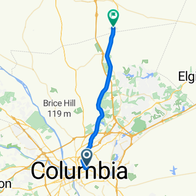
Earlewood Pi Mile 5K Course.
This road loop starts in Earlewood Park before crossing River Dr and through some of the most challenging grade changes within the Earlewood neighborhood before ending back where the course starts.- -:--
- Duration
- 5.2 km
- Distance
- 91 m
- Ascent
- 91 m
- Descent
- ---
- Avg. speed
- ---
- Max. altitude
Route quality
Waytypes & surfaces along the route
Waytypes
Quiet road
4.6 km
(89 %)
Road
0.6 km
(11 %)
Surfaces
Paved
3.4 km
(66 %)
Asphalt
3.4 km
(66 %)
Undefined
1.8 km
(34 %)
Continue with Bikemap
Use, edit, or download this cycling route
You would like to ride Earlewood Pi Loop or customize it for your own trip? Here is what you can do with this Bikemap route:
Free features
- Save this route as favorite or in collections
- Copy & plan your own version of this route
- Sync your route with Garmin or Wahoo
Premium features
Free trial for 3 days, or one-time payment. More about Bikemap Premium.
- Navigate this route on iOS & Android
- Export a GPX / KML file of this route
- Create your custom printout (try it for free)
- Download this route for offline navigation
Discover more Premium features.
Get Bikemap PremiumFrom our community
Other popular routes starting in Columbia
 Cracking ride in Ridgeway
- Distance
- 31.3 km
- Ascent
- 221 m
- Descent
- 150 m
- Location
- Columbia, South Carolina, United States
 Ride To Field
- Distance
- 7.8 km
- Ascent
- 45 m
- Descent
- 48 m
- Location
- Columbia, South Carolina, United States
 ride back home!
- Distance
- 152.8 km
- Ascent
- 1,516 m
- Descent
- 1,402 m
- Location
- Columbia, South Carolina, United States
 City Roots + Five Points
- Distance
- 13.6 km
- Ascent
- 102 m
- Descent
- 101 m
- Location
- Columbia, South Carolina, United States
 1219 Taylor St, Columbia to 102 Royal Ct, Chapin
- Distance
- 50.6 km
- Ascent
- 339 m
- Descent
- 325 m
- Location
- Columbia, South Carolina, United States
 Coliseum to Close Fipps
- Distance
- 1.9 km
- Ascent
- 43 m
- Descent
- 21 m
- Location
- Columbia, South Carolina, United States
 cola2home
- Distance
- 152.5 km
- Ascent
- 1,537 m
- Descent
- 1,411 m
- Location
- Columbia, South Carolina, United States
 Wednesday Street Meat
- Distance
- 16.3 km
- Ascent
- 98 m
- Descent
- 104 m
- Location
- Columbia, South Carolina, United States
Open it in the app