

Hilltraining
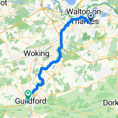
A cycling route starting in Walton on Thames, England, United Kingdom.
Overview
About this route
5 laps of Newlands Corner and Staple hill.
- -:--
- Duration
- 116.7 km
- Distance
- 1,136 m
- Ascent
- 1,153 m
- Descent
- ---
- Avg. speed
- ---
- Avg. speed
Route quality
Waytypes & surfaces along the route
Waytypes
Busy road
59.4 km
(51 %)
Quiet road
37 km
(32 %)
Surfaces
Paved
83.4 km
(71 %)
Unpaved
0.2 km
(<1 %)
Asphalt
82.7 km
(71 %)
Paved (undefined)
0.7 km
(<1 %)
Continue with Bikemap
Use, edit, or download this cycling route
You would like to ride Hilltraining or customize it for your own trip? Here is what you can do with this Bikemap route:
Free features
- Save this route as favorite or in collections
- Copy & plan your own version of this route
- Split it into stages to create a multi-day tour
- Sync your route with Garmin or Wahoo
Premium features
Free trial for 3 days, or one-time payment. More about Bikemap Premium.
- Navigate this route on iOS & Android
- Export a GPX / KML file of this route
- Create your custom printout (try it for free)
- Download this route for offline navigation
Discover more Premium features.
Get Bikemap PremiumFrom our community
Other popular routes starting in Walton on Thames
 Walton-on-Thames to Windsor.
- Distance
- 56.1 km
- Ascent
- 58 m
- Descent
- 57 m
- Location
- Walton on Thames, England, United Kingdom
 8F Sidney Road, Walton-on-Thames to 7B Sidney Road, Walton-on-Thames
- Distance
- 5.7 km
- Ascent
- 3 m
- Descent
- 3 m
- Location
- Walton on Thames, England, United Kingdom
 Windsor Loop Shorter
- Distance
- 58 km
- Ascent
- 164 m
- Descent
- 164 m
- Location
- Walton on Thames, England, United Kingdom
 greg ride v2
- Distance
- 82.6 km
- Ascent
- 304 m
- Descent
- 301 m
- Location
- Walton on Thames, England, United Kingdom
 Walton to Guildford (Towpath)
- Distance
- 31.5 km
- Ascent
- 253 m
- Descent
- 232 m
- Location
- Walton on Thames, England, United Kingdom
 BOXHILL THE EASY WAY
- Distance
- 46.4 km
- Ascent
- 289 m
- Descent
- 288 m
- Location
- Walton on Thames, England, United Kingdom
 Hilltraining
- Distance
- 116.7 km
- Ascent
- 1,136 m
- Descent
- 1,153 m
- Location
- Walton on Thames, England, United Kingdom
 krk100kmay15
- Distance
- 98.7 km
- Ascent
- 801 m
- Descent
- 802 m
- Location
- Walton on Thames, England, United Kingdom
Open it in the app