
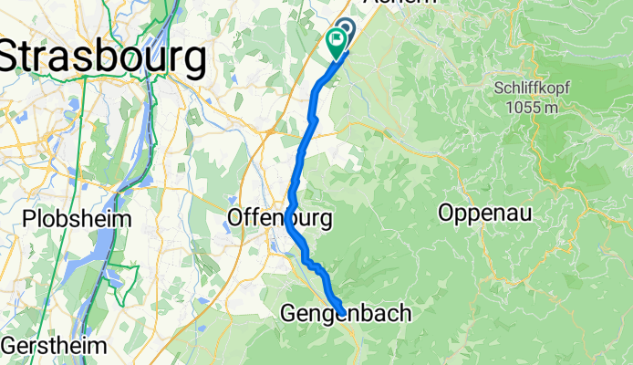
Renchen - Gengenbach
A cycling route starting in Renchen, Baden-Württemberg, Germany.
Overview
About this route
- 5 h 2 min
- Duration
- 51.8 km
- Distance
- 96 m
- Ascent
- 95 m
- Descent
- 10.3 km/h
- Avg. speed
- ---
- Avg. speed
Route quality
Waytypes & surfaces along the route
Waytypes
Track
14.3 km
(28 %)
Path
11.5 km
(22 %)
Surfaces
Paved
44.1 km
(85 %)
Unpaved
0.1 km
(<1 %)
Asphalt
41.3 km
(80 %)
Paving stones
2.3 km
(4 %)
Continue with Bikemap
Use, edit, or download this cycling route
You would like to ride Renchen - Gengenbach or customize it for your own trip? Here is what you can do with this Bikemap route:
Free features
- Save this route as favorite or in collections
- Copy & plan your own version of this route
- Sync your route with Garmin or Wahoo
Premium features
Free trial for 3 days, or one-time payment. More about Bikemap Premium.
- Navigate this route on iOS & Android
- Export a GPX / KML file of this route
- Create your custom printout (try it for free)
- Download this route for offline navigation
Discover more Premium features.
Get Bikemap PremiumFrom our community
Other popular routes starting in Renchen
 Renchen - Hanauer Radweg
- Distance
- 46.2 km
- Ascent
- 99 m
- Descent
- 100 m
- Location
- Renchen, Baden-Württemberg, Germany
 Bärlauch 2
- Distance
- 8.6 km
- Ascent
- 31 m
- Descent
- 36 m
- Location
- Renchen, Baden-Württemberg, Germany
 Renchen zum Rhein und zurück
- Distance
- 41.2 km
- Ascent
- 50 m
- Descent
- 50 m
- Location
- Renchen, Baden-Württemberg, Germany
 zur Schwend
- Distance
- 19.9 km
- Ascent
- 450 m
- Descent
- 450 m
- Location
- Renchen, Baden-Württemberg, Germany
 Weidenstraße 28, Renchen nach Weidenstraße 30A, Renchen
- Distance
- 56.6 km
- Ascent
- 216 m
- Descent
- 217 m
- Location
- Renchen, Baden-Württemberg, Germany
 Feierabendunde Dienstag 21.01.2014s
- Distance
- 19.2 km
- Ascent
- 307 m
- Descent
- 326 m
- Location
- Renchen, Baden-Württemberg, Germany
 Kutzenstein Rineglbacher Kreuz
- Distance
- 23.6 km
- Ascent
- 282 m
- Descent
- 282 m
- Location
- Renchen, Baden-Württemberg, Germany
 Bildeiche-Runde
- Distance
- 36.2 km
- Ascent
- 425 m
- Descent
- 425 m
- Location
- Renchen, Baden-Württemberg, Germany
Open it in the app