

Werra-Burgen-Steig Hessen
A cycling route starting in Bad Sooden-Allendorf, Hesse, Germany.
Overview
About this route
Auf dieser Etappe des Werra-Burgen-Steig Hessen geht es zunächst dicht entlang der Werra mitten hinein in die Hessische Schweiz. Schon der Aufstieg dorthin ist gesäumt von echten Highlights – die dann doch „nur“ das Vorspiel bilden. Hier im NaturparkMeißner-Kaufunger Wald erwartet den Wanderer ein wahrer Landschaftstraum, belebte Burgen und Blicke auf die Werra und ihr Tal. Naturbelassene Pfade, einmalige Aussichten, beeindruckende Felslandschaften und ein Ausflug zum Grünen Band hinterlassen bleibende Erlebnisse.
- -:--
- Duration
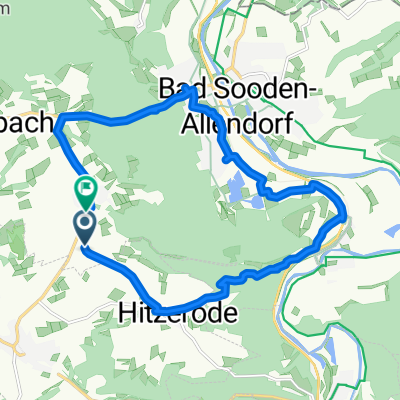
- 12.9 km
- Distance
- 467 m
- Ascent
- 274 m
- Descent
- ---
- Avg. speed
- ---
- Max. altitude
Route quality
Waytypes & surfaces along the route
Waytypes
Track
6.1 km
(47 %)
Path
5.6 km
(43 %)
Surfaces
Paved
3.9 km
(31 %)
Unpaved
8.7 km
(67 %)
Ground
5.5 km
(43 %)
Asphalt
2.4 km
(19 %)
Continue with Bikemap
Use, edit, or download this cycling route
You would like to ride Werra-Burgen-Steig Hessen or customize it for your own trip? Here is what you can do with this Bikemap route:
Free features
- Save this route as favorite or in collections
- Copy & plan your own version of this route
- Sync your route with Garmin or Wahoo
Premium features
Free trial for 3 days, or one-time payment. More about Bikemap Premium.
- Navigate this route on iOS & Android
- Export a GPX / KML file of this route
- Create your custom printout (try it for free)
- Download this route for offline navigation
Discover more Premium features.
Get Bikemap PremiumFrom our community
Other popular routes starting in Bad Sooden-Allendorf
 Sonntagsruhe
- Distance
- 55.1 km
- Ascent
- 408 m
- Descent
- 403 m
- Location
- Bad Sooden-Allendorf, Hesse, Germany
 BSA Route 6
- Distance
- 36.9 km
- Ascent
- 235 m
- Descent
- 245 m
- Location
- Bad Sooden-Allendorf, Hesse, Germany
 Kleinvach - Meinhard - Neuerode - Gobert - Alten Stein
- Distance
- 43 km
- Ascent
- 632 m
- Descent
- 632 m
- Location
- Bad Sooden-Allendorf, Hesse, Germany
 Bad Sooden-Allendorf Cycling
- Distance
- 12.4 km
- Ascent
- 8 m
- Descent
- 4 m
- Location
- Bad Sooden-Allendorf, Hesse, Germany
 Bad Sooden-Allendorf - Eichsfeld
- Distance
- 83.4 km
- Ascent
- 478 m
- Descent
- 478 m
- Location
- Bad Sooden-Allendorf, Hesse, Germany
 Große Hainstraße 2, Bad Sooden-Allendorf nach Weinreihe 5, Bad Sooden-Allendorf
- Distance
- 62.8 km
- Ascent
- 241 m
- Descent
- 250 m
- Location
- Bad Sooden-Allendorf, Hesse, Germany
 Bad Sooden 1
- Distance
- 14.3 km
- Ascent
- 253 m
- Descent
- 263 m
- Location
- Bad Sooden-Allendorf, Hesse, Germany
 Bikeführer MTB "Auf die Gobert"
- Distance
- 23.9 km
- Ascent
- 610 m
- Descent
- 527 m
- Location
- Bad Sooden-Allendorf, Hesse, Germany
Open it in the app