Rund um Aying
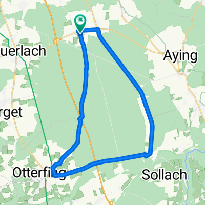
A cycling route starting in Brunnthal, Bavaria, Germany.
Overview
About this route
Auf Radwegen und Nebenstrecken rund um Aying. Von Münster in´s Reisenthal steile Abfahrt und vom Reisenthal nach Loipersdorf kurze aber steile Auffahrt.
(cloned from route 15366)
- -:--
- Duration
- 39.4 km
- Distance
- 195 m
- Ascent
- 195 m
- Descent
- ---
- Avg. speed
- ---
- Avg. speed
Route quality
Waytypes & surfaces along the route
Waytypes
Quiet road
21.6 km
(55 %)
Road
9.2 km
(23 %)
Surfaces
Paved
36.7 km
(93 %)
Unpaved
1.4 km
(4 %)
Asphalt
36.5 km
(92 %)
Unpaved (undefined)
1 km
(2 %)
Continue with Bikemap
Use, edit, or download this cycling route
You would like to ride Rund um Aying or customize it for your own trip? Here is what you can do with this Bikemap route:
Free features
- Save this route as favorite or in collections
- Copy & plan your own version of this route
- Sync your route with Garmin or Wahoo
Premium features
Free trial for 3 days, or one-time payment. More about Bikemap Premium.
- Navigate this route on iOS & Android
- Export a GPX / KML file of this route
- Create your custom printout (try it for free)
- Download this route for offline navigation
Discover more Premium features.
Get Bikemap PremiumFrom our community
Other popular routes starting in Brunnthal
- Otterloh - Deisenhofener Forst - Sauerlach
- Distance
- 16.4 km
- Ascent
- 118 m
- Descent
- 120 m
- Location
- Brunnthal, Bavaria, Germany
- Hofoldinger TT-Runde
- Distance
- 23.9 km
- Ascent
- 99 m
- Descent
- 96 m
- Location
- Brunnthal, Bavaria, Germany
- Route in Brunnthal
- Distance
- 36 km
- Ascent
- 170 m
- Descent
- 170 m
- Location
- Brunnthal, Bavaria, Germany
- Kichstockach-Otterfing-Kreuzsraße-Valley-Holzkirchen-Sauerlach
- Distance
- 58.8 km
- Ascent
- 211 m
- Descent
- 211 m
- Location
- Brunnthal, Bavaria, Germany
- Rund um Aying
- Distance
- 39.4 km
- Ascent
- 195 m
- Descent
- 195 m
- Location
- Brunnthal, Bavaria, Germany
- Walchstatt - Ascholding
- Distance
- 82.5 km
- Ascent
- 563 m
- Descent
- 563 m
- Location
- Brunnthal, Bavaria, Germany
- Hofolding-Sauerlach-Grosseichenhausen-Arget-Otterloh-Hofolding
- Distance
- 33.5 km
- Ascent
- 213 m
- Descent
- 212 m
- Location
- Brunnthal, Bavaria, Germany
- Deininger Weiher
- Distance
- 38.2 km
- Ascent
- 180 m
- Descent
- 180 m
- Location
- Brunnthal, Bavaria, Germany
Open it in the app