

Lake Annecy Loop via Col de la Forclaz
A cycling route starting in Annecy-le-Vieux, Auvergne-Rhône-Alpes, France.
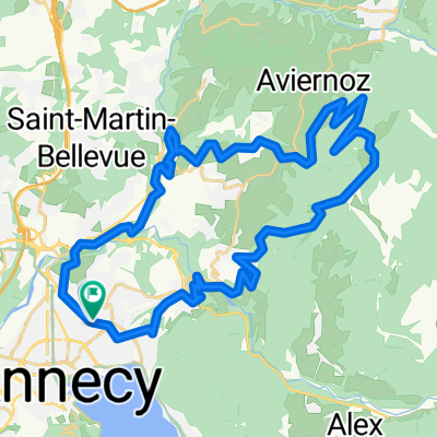
Overview
About this route
A very scenic loop around Lac d'Annecy
- -:--
- Duration
- 49.4 km
- Distance
- 733 m
- Ascent
- 734 m
- Descent
- ---
- Avg. speed
- ---
- Max. altitude

Route quality
Waytypes & surfaces along the route
Waytypes
Cycleway
24.2 km
(49 %)
Road
13.6 km
(28 %)
Surfaces
Paved
47.2 km
(96 %)
Unpaved
0.3 km
(<1 %)
Asphalt
47 km
(95 %)
Loose gravel
0.2 km
(<1 %)
Route highlights
Points of interest along the route
Point of interest after 31.9 km
Col de la Forclaz
Continue with Bikemap
Use, edit, or download this cycling route
You would like to ride Lake Annecy Loop via Col de la Forclaz or customize it for your own trip? Here is what you can do with this Bikemap route:
Free features
- Save this route as favorite or in collections
- Copy & plan your own version of this route
- Sync your route with Garmin or Wahoo
Premium features
Free trial for 3 days, or one-time payment. More about Bikemap Premium.
- Navigate this route on iOS & Android
- Export a GPX / KML file of this route
- Create your custom printout (try it for free)
- Download this route for offline navigation
Discover more Premium features.
Get Bikemap PremiumFrom our community
Other popular routes starting in Annecy-le-Vieux
 Col hunting through Rumilly
- Distance
- 94.5 km
- Ascent
- 1,634 m
- Descent
- 1,634 m
- Location
- Annecy-le-Vieux, Auvergne-Rhône-Alpes, France
 alevieux chalet chappuis naves
- Distance
- 40.4 km
- Ascent
- 1,292 m
- Descent
- 1,293 m
- Location
- Annecy-le-Vieux, Auvergne-Rhône-Alpes, France
 Tour Veyrier
- Distance
- 25.8 km
- Ascent
- 417 m
- Descent
- 414 m
- Location
- Annecy-le-Vieux, Auvergne-Rhône-Alpes, France
 Tour du Veyrier
- Distance
- 23.3 km
- Ascent
- 398 m
- Descent
- 405 m
- Location
- Annecy-le-Vieux, Auvergne-Rhône-Alpes, France
 meer van Annecy, France à Roul' ma Poule location vélo Annecy le Vieux
- Distance
- 39.4 km
- Ascent
- 0 m
- Descent
- 0 m
- Location
- Annecy-le-Vieux, Auvergne-Rhône-Alpes, France
 De 17T Chemin des Chapelaines, Annecy-le-Vieux à 17Bis Chemin des Chapelaines, Annecy-le-Vieux
- Distance
- 25.2 km
- Ascent
- 1,096 m
- Descent
- 1,097 m
- Location
- Annecy-le-Vieux, Auvergne-Rhône-Alpes, France
 FA05 Albertville
- Distance
- 58.9 km
- Ascent
- 147 m
- Descent
- 235 m
- Location
- Annecy-le-Vieux, Auvergne-Rhône-Alpes, France
 Col de la Colombiere - grande boucle
- Distance
- 113.4 km
- Ascent
- 1,798 m
- Descent
- 1,799 m
- Location
- Annecy-le-Vieux, Auvergne-Rhône-Alpes, France
Open it in the app