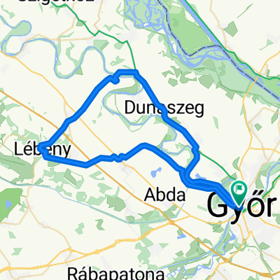
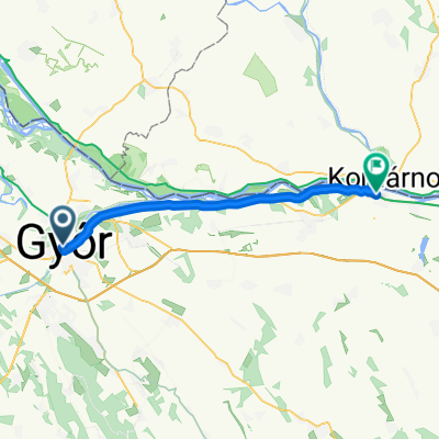
Győr-Hilltop
A cycling route starting in Győr, Győr-Moson-Sopron, Hungary.
Overview
About this route
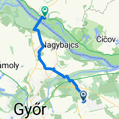
Győr-Hilltop kerékpárral
- -:--
- Duration
- 64.7 km
- Distance
- 211 m
- Ascent
- 65 m
- Descent
- ---
- Avg. speed
- ---
- Max. altitude
Continue with Bikemap
Use, edit, or download this cycling route
You would like to ride Győr-Hilltop or customize it for your own trip? Here is what you can do with this Bikemap route:
Free features
- Save this route as favorite or in collections
- Copy & plan your own version of this route
- Sync your route with Garmin or Wahoo
Premium features
Free trial for 3 days, or one-time payment. More about Bikemap Premium.
- Navigate this route on iOS & Android
- Export a GPX / KML file of this route
- Create your custom printout (try it for free)
- Download this route for offline navigation
Discover more Premium features.
Get Bikemap PremiumFrom our community
Other popular routes starting in Győr
- Véletlenszerűen északnak
- Distance
- 33.6 km
- Ascent
- 25 m
- Descent
- 26 m
- Location
- Győr, Győr-Moson-Sopron, Hungary
- Baross Gábor út 2, Győr to Dunakapu tér 1, Győr
- Distance
- 0.3 km
- Ascent
- 8 m
- Descent
- 0 m
- Location
- Győr, Győr-Moson-Sopron, Hungary
- Győr - Pannonhalma kerékpárút
- Distance
- 19.5 km
- Ascent
- 62 m
- Descent
- 11 m
- Location
- Győr, Győr-Moson-Sopron, Hungary
- Kőrihegy - és vissza
- Distance
- 106.9 km
- Ascent
- 696 m
- Descent
- 686 m
- Location
- Győr, Győr-Moson-Sopron, Hungary
- Győr, Szabolcska Mihály utca 21-Győrszemere Szőlőhegyen
- Distance
- 17.7 km
- Ascent
- 48 m
- Descent
- 19 m
- Location
- Győr, Győr-Moson-Sopron, Hungary
- Kajakos madárvadászat a Mosoni Dunán
- Distance
- 7.9 km
- Ascent
- 20 m
- Descent
- 22 m
- Location
- Győr, Győr-Moson-Sopron, Hungary
- Győr-Szigetköz karika 1 nap alatt
- Distance
- 58.5 km
- Ascent
- 28 m
- Descent
- 27 m
- Location
- Győr, Győr-Moson-Sopron, Hungary
- Győr - Komárno
- Distance
- 71.2 km
- Ascent
- 50 m
- Descent
- 56 m
- Location
- Győr, Győr-Moson-Sopron, Hungary
Open it in the app