

Giro dei matti
A cycling route starting in Lambrinia, Lombardy, Italy.
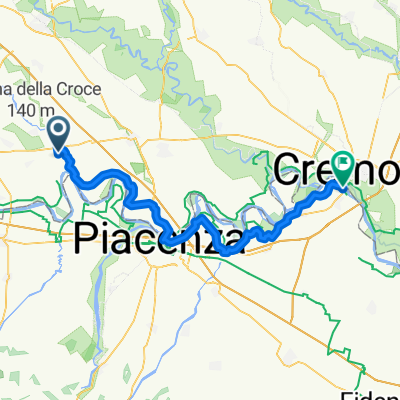
Overview
About this route
Light ride in the countryside of San Colombano
- -:--
- Duration
- 8.4 km
- Distance
- 15 m
- Ascent
- 16 m
- Descent
- ---
- Avg. speed
- ---
- Max. altitude
Route quality
Waytypes & surfaces along the route
Waytypes
Quiet road
4 km
(48 %)
Path
0.2 km
(2 %)
Undefined
4.2 km
(50 %)
Surfaces
Paved
1.8 km
(21 %)
Asphalt
1.8 km
(21 %)
Undefined
6.6 km
(79 %)
Continue with Bikemap
Use, edit, or download this cycling route
You would like to ride Giro dei matti or customize it for your own trip? Here is what you can do with this Bikemap route:
Free features
- Save this route as favorite or in collections
- Copy & plan your own version of this route
- Sync your route with Garmin or Wahoo
Premium features
Free trial for 3 days, or one-time payment. More about Bikemap Premium.
- Navigate this route on iOS & Android
- Export a GPX / KML file of this route
- Create your custom printout (try it for free)
- Download this route for offline navigation
Discover more Premium features.
Get Bikemap PremiumFrom our community
Other popular routes starting in Lambrinia
 Giro dei matti
- Distance
- 8.4 km
- Ascent
- 15 m
- Descent
- 16 m
- Location
- Lambrinia, Lombardy, Italy
 6/6) San Colombano al Lambro- Orio Litta- Lodi- Bergamo
- Distance
- 86.8 km
- Ascent
- 365 m
- Descent
- 195 m
- Location
- Lambrinia, Lombardy, Italy
 Lambrinia - Castelvetro Piacentino
- Distance
- 63.8 km
- Ascent
- 78 m
- Descent
- 104 m
- Location
- Lambrinia, Lombardy, Italy
 Tappa 4B
- Distance
- 79.8 km
- Ascent
- 32 m
- Descent
- 59 m
- Location
- Lambrinia, Lombardy, Italy
 2013lib2a
- Distance
- 21.8 km
- Ascent
- 30 m
- Descent
- 35 m
- Location
- Lambrinia, Lombardy, Italy
 SS 234 5, San Colombano al Lambro a Via Alfredo E Antonio di Dio Emma 1, Cremona
- Distance
- 39.7 km
- Ascent
- 80 m
- Descent
- 101 m
- Location
- Lambrinia, Lombardy, Italy
 Lambro
- Distance
- 4.9 km
- Ascent
- 15 m
- Descent
- 13 m
- Location
- Lambrinia, Lombardy, Italy
 san colombano - monticelli d'ongina
- Distance
- 47.2 km
- Ascent
- 44 m
- Descent
- 68 m
- Location
- Lambrinia, Lombardy, Italy
Open it in the app