
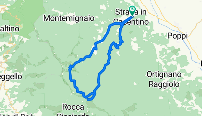
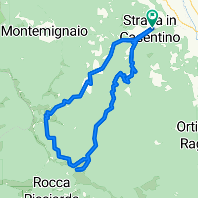
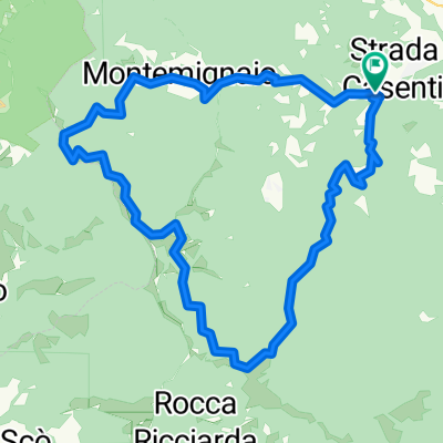
Vette e Acque del Pratomagno
A cycling route starting in Castel San Niccolò, Tuscany, Italy.
Overview
About this route
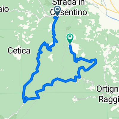
Anello da Castel San Niccolò. Garliano, Croce del Pratomagno, Bagni di Cetica, Castel San Niccolò.
- -:--
- Duration
- 34.6 km
- Distance
- 1,277 m
- Ascent
- 1,284 m
- Descent
- ---
- Avg. speed
- ---
- Max. altitude

Route quality
Waytypes & surfaces along the route
Waytypes
Quiet road
18.2 km
(52 %)
Track
9.7 km
(28 %)
Surfaces
Paved
7.9 km
(23 %)
Unpaved
13.6 km
(39 %)
Unpaved (undefined)
8.2 km
(24 %)
Asphalt
6.8 km
(20 %)
Continue with Bikemap
Use, edit, or download this cycling route
You would like to ride Vette e Acque del Pratomagno or customize it for your own trip? Here is what you can do with this Bikemap route:
Free features
- Save this route as favorite or in collections
- Copy & plan your own version of this route
- Sync your route with Garmin or Wahoo
Premium features
Free trial for 3 days, or one-time payment. More about Bikemap Premium.
- Navigate this route on iOS & Android
- Export a GPX / KML file of this route
- Create your custom printout (try it for free)
- Download this route for offline navigation
Discover more Premium features.
Get Bikemap PremiumFrom our community
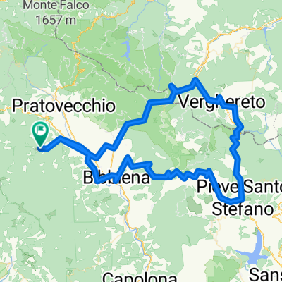
Other popular routes starting in Castel San Niccolò
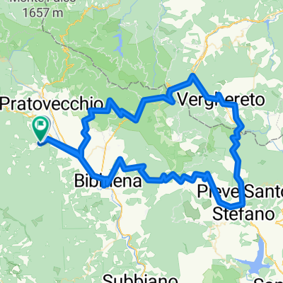 camaldoli pieve s.stefano la verna
- Distance
- 128.1 km
- Ascent
- 2,087 m
- Descent
- 2,081 m
- Location
- Castel San Niccolò, Tuscany, Italy
 Vette e Acque del Pratomagno
- Distance
- 34.6 km
- Ascent
- 1,277 m
- Descent
- 1,284 m
- Location
- Castel San Niccolò, Tuscany, Italy
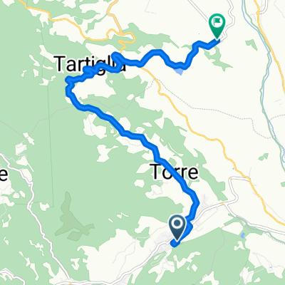 Strada Torre Pieve Di Romena
- Distance
- 8.8 km
- Ascent
- 315 m
- Descent
- 210 m
- Location
- Castel San Niccolò, Tuscany, Italy
 MTB Tour Pratomagno Secchieta
- Distance
- 38.7 km
- Ascent
- 1,259 m
- Descent
- 1,257 m
- Location
- Castel San Niccolò, Tuscany, Italy
 Casentino South
- Distance
- 119.6 km
- Ascent
- 2,067 m
- Descent
- 2,067 m
- Location
- Castel San Niccolò, Tuscany, Italy
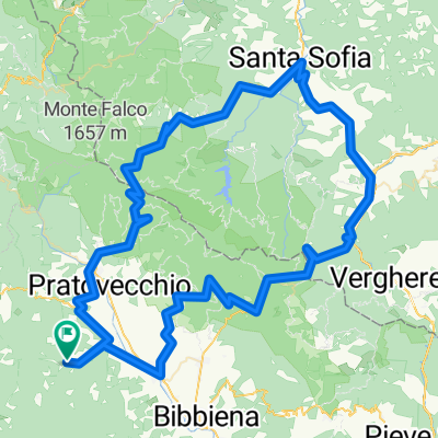 Casentino North
- Distance
- 128.5 km
- Ascent
- 2,512 m
- Descent
- 2,512 m
- Location
- Castel San Niccolò, Tuscany, Italy
 Casentino East Round
- Distance
- 125 km
- Ascent
- 1,892 m
- Descent
- 1,892 m
- Location
- Castel San Niccolò, Tuscany, Italy
 Prato di Strada - Garliano - Quorle
- Distance
- 25.2 km
- Ascent
- 1,073 m
- Descent
- 825 m
- Location
- Castel San Niccolò, Tuscany, Italy
Open it in the app