

Testrunden
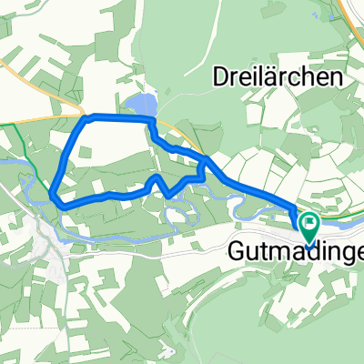
A cycling route starting in Geisingen, Baden-Württemberg, Germany.
Overview
About this route
Optimale Strecke, um neue Einstellungen etc. zu testen da sowohl leichte Steigungen , gerade Abschnitte als auch leichte Gefälle auf der Strecke vorhanden sind.
- -:--
- Duration
- 3.3 km
- Distance
- 28 m
- Ascent
- 22 m
- Descent
- ---
- Avg. speed
- 719 m
- Avg. speed

Route quality
Waytypes & surfaces along the route
Waytypes
Track
2.9 km
(88 %)
Quiet road
0.4 km
(12 %)
Surfaces
Paved
2.9 km
(88 %)
Paved (undefined)
1.7 km
(50 %)
Asphalt
1.3 km
(38 %)
Undefined
0.4 km
(12 %)
Continue with Bikemap
Use, edit, or download this cycling route
You would like to ride Testrunden or customize it for your own trip? Here is what you can do with this Bikemap route:
Free features
- Save this route as favorite or in collections
- Copy & plan your own version of this route
- Sync your route with Garmin or Wahoo
Premium features
Free trial for 3 days, or one-time payment. More about Bikemap Premium.
- Navigate this route on iOS & Android
- Export a GPX / KML file of this route
- Create your custom printout (try it for free)
- Download this route for offline navigation
Discover more Premium features.
Get Bikemap PremiumFrom our community
Other popular routes starting in Geisingen
 Regensburg-Offenburg 10
- Distance
- 71.2 km
- Ascent
- 343 m
- Descent
- 652 m
- Location
- Geisingen, Baden-Württemberg, Germany
 Geisingen nach Blumber Zollhaus (Sauschwänzlebahn)
- Distance
- 17.3 km
- Ascent
- 167 m
- Descent
- 132 m
- Location
- Geisingen, Baden-Württemberg, Germany
 Gutmadingen - Neudingen - Gutmadingen
- Distance
- 9.7 km
- Ascent
- 35 m
- Descent
- 35 m
- Location
- Geisingen, Baden-Württemberg, Germany
 K 5922, Immendingen nach Schwarzwaldstraße 52, Immendingen
- Distance
- 4.8 km
- Ascent
- 29 m
- Descent
- 26 m
- Location
- Geisingen, Baden-Württemberg, Germany
 Geislngen - Konstanz (busparkeerterrein)
- Distance
- 71.8 km
- Ascent
- 539 m
- Descent
- 811 m
- Location
- Geisingen, Baden-Württemberg, Germany
 Friedhofstraße, Geisingen nach Leipferdinger Straße 26, Tengen
- Distance
- 12.1 km
- Ascent
- 199 m
- Descent
- 236 m
- Location
- Geisingen, Baden-Württemberg, Germany
 Testrunden
- Distance
- 3.3 km
- Ascent
- 28 m
- Descent
- 22 m
- Location
- Geisingen, Baden-Württemberg, Germany
 Bachweg 9, Bad Dürrheim nach Bachweg 12, Bad Dürrheim
- Distance
- 35.5 km
- Ascent
- 170 m
- Descent
- 119 m
- Location
- Geisingen, Baden-Württemberg, Germany
Open it in the app