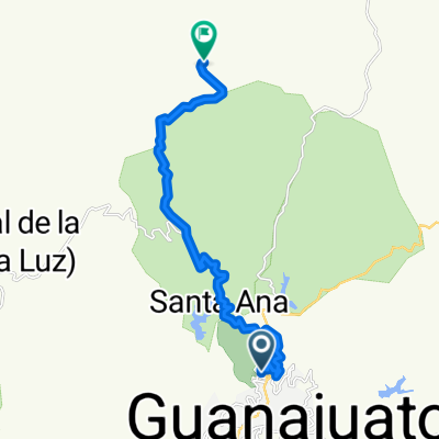
J72 β Mardi 22 mars 2016 β Guanajuato β Dolores Hidalgo
A cycling route starting in Guanajuato City, Guanajuato, Mexico.
Overview
About this route
J72 β Tuesday, March 22, 2016 β Guanajuato β Dolores Hidalgo
57.18 Kms β Average 11.12 Kms/h Elevation gain 949 meters β Max grade 10 % Elevation loss 1005 meters β Max grade 9 % Max altitude 2617 meters β Finish altitude 1907 meters- -:--
- Duration
- 57.6 km
- Distance
- 860 m
- Ascent
- 947 m
- Descent
- ---
- Avg. speed
- ---
- Max. altitude
Continue with Bikemap
Use, edit, or download this cycling route
You would like to ride J72 β Mardi 22 mars 2016 β Guanajuato β Dolores Hidalgo or customize it for your own trip? Here is what you can do with this Bikemap route:
Free features
- Save this route as favorite or in collections
- Copy & plan your own version of this route
- Sync your route with Garmin or Wahoo
Premium features
Free trial for 3 days, or one-time payment. More about Bikemap Premium.
- Navigate this route on iOS & Android
- Export a GPX / KML file of this route
- Create your custom printout (try it for free)
- Download this route for offline navigation
Discover more Premium features.
Get Bikemap PremiumFrom our community
Other popular routes starting in Guanajuato City
- Guanajuato - Carretera panorΓ‘mica
- Distance
- 26 km
- Ascent
- 412 m
- Descent
- 413 m
- Location
- Guanajuato City, Guanajuato, Mexico
- Mineral del Cubo Guanajuato
- Distance
- 24.9 km
- Ascent
- 641 m
- Descent
- 636 m
- Location
- Guanajuato City, Guanajuato, Mexico
- Guanajuato (San Javier)-Cristo Rey
- Distance
- 27.7 km
- Ascent
- 777 m
- Descent
- 290 m
- Location
- Guanajuato City, Guanajuato, Mexico
- Guanajuato (San Javier)-CaΓ±ada de la Virgen
- Distance
- 27.2 km
- Ascent
- 723 m
- Descent
- 572 m
- Location
- Guanajuato City, Guanajuato, Mexico
- Mineral del Cubo Guanajuato
- Distance
- 25 km
- Ascent
- 638 m
- Descent
- 620 m
- Location
- Guanajuato City, Guanajuato, Mexico
- Guanajuato (San Javier)-Santa Rosa por San Nicolas rumbo al Cubo
- Distance
- 43 km
- Ascent
- 976 m
- Descent
- 976 m
- Location
- Guanajuato City, Guanajuato, Mexico
- Guanajuato (San Javier)-El Cubo
- Distance
- 21.3 km
- Ascent
- 627 m
- Descent
- 426 m
- Location
- Guanajuato City, Guanajuato, Mexico
- Guanajuato-El Cubo-Sn. Miguel-
- Distance
- 74.5 km
- Ascent
- 871 m
- Descent
- 1,034 m
- Location
- Guanajuato City, Guanajuato, Mexico
Open it in the app