
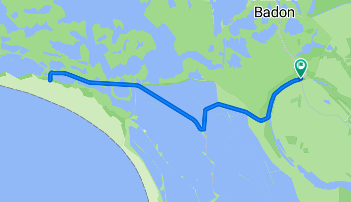
Zum Phare de Gacholle
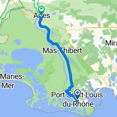
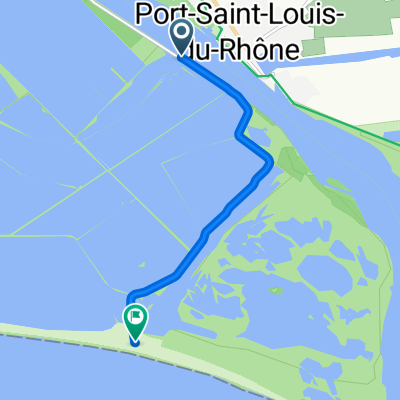
A cycling route starting in Port-Saint-Louis-du-Rhône, Provence-Alpes-Côte d'Azur Region, France.
Overview
About this route
Shortly after the Phare de Gacholle, you can walk over the sandy beach to the sea (the beach here is nearly a kilometer wide) and be there alone.
- -:--
- Duration
- 23.1 km
- Distance
- 0 m
- Ascent
- 0 m
- Descent
- ---
- Avg. speed
- ---
- Max. altitude
Continue with Bikemap
Use, edit, or download this cycling route
You would like to ride Zum Phare de Gacholle or customize it for your own trip? Here is what you can do with this Bikemap route:
Free features
- Save this route as favorite or in collections
- Copy & plan your own version of this route
- Sync your route with Garmin or Wahoo
Premium features
Free trial for 3 days, or one-time payment. More about Bikemap Premium.
- Navigate this route on iOS & Android
- Export a GPX / KML file of this route
- Create your custom printout (try it for free)
- Download this route for offline navigation
Discover more Premium features.
Get Bikemap PremiumFrom our community
Other popular routes starting in Port-Saint-Louis-du-Rhône
 SALIN DE GIRAUD -LES SAINTES MARIES DE LA MER-AIGUES MORTES-ARLES
- Distance
- 169.7 km
- Ascent
- 0 m
- Descent
- 0 m
- Location
- Port-Saint-Louis-du-Rhône, Provence-Alpes-Côte d'Azur Region, France
 ET4 // Port Saint Louis du Rhône - Arles
- Distance
- 43.5 km
- Ascent
- 35 m
- Descent
- 18 m
- Location
- Port-Saint-Louis-du-Rhône, Provence-Alpes-Côte d'Azur Region, France
 Route de Port-Saint-Louis-du-Rhône, Port-Saint-Louis-du-Rhône à 9 Avenue Léon Gambetta, Saintes-Maries-de-la-Mer
- Distance
- 39.6 km
- Ascent
- 5 m
- Descent
- 4 m
- Location
- Port-Saint-Louis-du-Rhône, Provence-Alpes-Côte d'Azur Region, France
 de giraud -marsiglia 82 km
- Distance
- 82.5 km
- Ascent
- 476 m
- Descent
- 458 m
- Location
- Port-Saint-Louis-du-Rhône, Provence-Alpes-Côte d'Azur Region, France
 627) Port Saint Louis du Rhône - Arles
- Distance
- 67.4 km
- Ascent
- 5 m
- Descent
- 6 m
- Location
- Port-Saint-Louis-du-Rhône, Provence-Alpes-Côte d'Azur Region, France
 Chemin du Bac de Barcarin Salin, Arles nach Saintes Maries de la Mer
- Distance
- 31.5 km
- Ascent
- 0 m
- Descent
- 0 m
- Location
- Port-Saint-Louis-du-Rhône, Provence-Alpes-Côte d'Azur Region, France
 Salins de Giraud à la mer
- Distance
- 5.9 km
- Ascent
- 0 m
- Descent
- 0 m
- Location
- Port-Saint-Louis-du-Rhône, Provence-Alpes-Côte d'Azur Region, France
 Zum Phare de Gacholle
- Distance
- 23.1 km
- Ascent
- 0 m
- Descent
- 0 m
- Location
- Port-Saint-Louis-du-Rhône, Provence-Alpes-Côte d'Azur Region, France
Open it in the app