

Overview
About this route
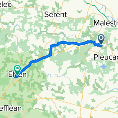
Tour around Sue & Clive day 1
(cloned from route 3452209)
- -:--
- Duration
- 55.5 km
- Distance
- 436 m
- Ascent
- 436 m
- Descent
- ---
- Avg. speed
- ---
- Max. altitude

Part of
Tournesol
3 stages
Route quality
Waytypes & surfaces along the route
Waytypes
Quiet road
26.6 km
(48 %)
Road
22.2 km
(40 %)
Surfaces
Paved
52.2 km
(94 %)
Asphalt
49.4 km
(89 %)
Paved (undefined)
2.8 km
(5 %)
Undefined
3.3 km
(6 %)
Continue with Bikemap
Use, edit, or download this cycling route
You would like to ride Tournesol 1 or customize it for your own trip? Here is what you can do with this Bikemap route:
Free features
- Save this route as favorite or in collections
- Copy & plan your own version of this route
- Sync your route with Garmin or Wahoo
Premium features
Free trial for 3 days, or one-time payment. More about Bikemap Premium.
- Navigate this route on iOS & Android
- Export a GPX / KML file of this route
- Create your custom printout (try it for free)
- Download this route for offline navigation
Discover more Premium features.
Get Bikemap PremiumFrom our community
Other popular routes starting in Pleucadeuc
 Tournesol 2
- Distance
- 67.6 km
- Ascent
- 292 m
- Descent
- 292 m
- Location
- Pleucadeuc, Brittany Region, France
 Saint Congard_Kerfulus
- Distance
- 87.7 km
- Ascent
- 246 m
- Descent
- 177 m
- Location
- Pleucadeuc, Brittany Region, France
 20150325_093125.gpx
- Distance
- 27.3 km
- Ascent
- 241 m
- Descent
- 186 m
- Location
- Pleucadeuc, Brittany Region, France
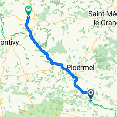
 Tournesol 1
- Distance
- 55.5 km
- Ascent
- 436 m
- Descent
- 436 m
- Location
- Pleucadeuc, Brittany Region, France
 Pleucadeuc à 8 Rue Gambert, Elven
- Distance
- 18.1 km
- Ascent
- 198 m
- Descent
- 152 m
- Location
- Pleucadeuc, Brittany Region, France
 Tournesol 3
- Distance
- 69.7 km
- Ascent
- 379 m
- Descent
- 374 m
- Location
- Pleucadeuc, Brittany Region, France
 Pleucadeuc - Trévé
- Distance
- 77.7 km
- Ascent
- 537 m
- Descent
- 389 m
- Location
- Pleucadeuc, Brittany Region, France
 Rue des Menhirs, Pleucadeuc à Rue des Menhirs, Pleucadeuc
- Distance
- 28.4 km
- Ascent
- 223 m
- Descent
- 223 m
- Location
- Pleucadeuc, Brittany Region, France
Open it in the app