

Pelezão / sub prefeitura
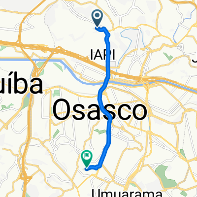
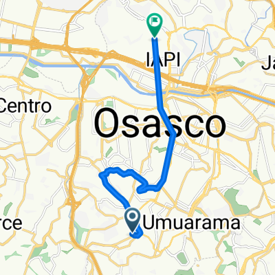
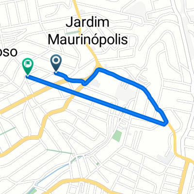
A cycling route starting in Osasco, São Paulo, Brazil.
Overview
About this route
- -:--
- Duration
- 3.5 km
- Distance
- 24 m
- Ascent
- 55 m
- Descent
- ---
- Avg. speed
- ---
- Max. altitude
Route highlights
Points of interest along the route
Point of interest after 3.5 km
Sub prefeitura da LAPA
Continue with Bikemap
Use, edit, or download this cycling route
You would like to ride Pelezão / sub prefeitura or customize it for your own trip? Here is what you can do with this Bikemap route:
Free features
- Save this route as favorite or in collections
- Copy & plan your own version of this route
- Sync your route with Garmin or Wahoo
Premium features
Free trial for 3 days, or one-time payment. More about Bikemap Premium.
- Navigate this route on iOS & Android
- Export a GPX / KML file of this route
- Create your custom printout (try it for free)
- Download this route for offline navigation
Discover more Premium features.
Get Bikemap PremiumFrom our community
Other popular routes starting in Osasco
 treino matinal
- Distance
- 64.6 km
- Ascent
- 1,235 m
- Descent
- 1,220 m
- Location
- Osasco, São Paulo, Brazil
 Route Bike - Giro Caminho do Mar
- Distance
- 111.3 km
- Ascent
- 567 m
- Descent
- 567 m
- Location
- Osasco, São Paulo, Brazil
 Viagem 6
- Distance
- 6.9 km
- Ascent
- 97 m
- Descent
- 86 m
- Location
- Osasco, São Paulo, Brazil
 Viagem 5
- Distance
- 11.1 km
- Ascent
- 140 m
- Descent
- 172 m
- Location
- Osasco, São Paulo, Brazil
 02- Oz-Vila- Morumbi
- Distance
- 25.3 km
- Ascent
- 185 m
- Descent
- 187 m
- Location
- Osasco, São Paulo, Brazil
 03- Oz-Vila (ida e volta)
- Distance
- 26.2 km
- Ascent
- 219 m
- Descent
- 234 m
- Location
- Osasco, São Paulo, Brazil
 viagem 1
- Distance
- 1.9 km
- Ascent
- 18 m
- Descent
- 20 m
- Location
- Osasco, São Paulo, Brazil
 USP - Parque do Ibirapuera
- Distance
- 11.6 km
- Ascent
- 137 m
- Descent
- 144 m
- Location
- Osasco, São Paulo, Brazil
Open it in the app