
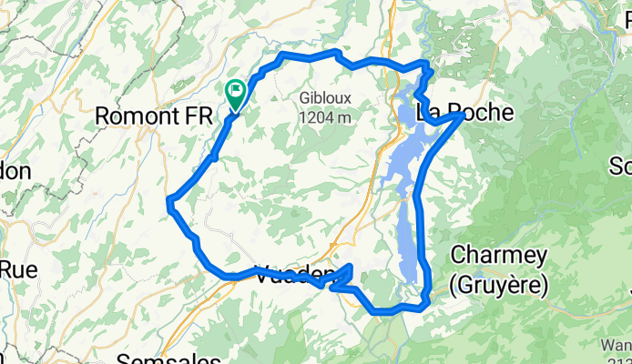
Tour du lac de Gruyères
A cycling route starting in Villaz-Saint-Pierre, Canton of Fribourg, Switzerland.
Overview
About this route
I feel my legs...
- -:--
- Duration
- 58.9 km
- Distance
- 394 m
- Ascent
- 393 m
- Descent
- ---
- Avg. speed
- ---
- Max. altitude

Route quality
Waytypes & surfaces along the route
Waytypes
Road
21.8 km
(37 %)
Quiet road
10 km
(17 %)
Surfaces
Paved
20 km
(34 %)
Unpaved
0.6 km
(1 %)
Asphalt
20 km
(34 %)
Gravel
0.6 km
(1 %)
Undefined
38.3 km
(65 %)
Continue with Bikemap
Use, edit, or download this cycling route
You would like to ride Tour du lac de Gruyères or customize it for your own trip? Here is what you can do with this Bikemap route:
Free features
- Save this route as favorite or in collections
- Copy & plan your own version of this route
- Sync your route with Garmin or Wahoo
Premium features
Free trial for 3 days, or one-time payment. More about Bikemap Premium.
- Navigate this route on iOS & Android
- Export a GPX / KML file of this route
- Create your custom printout (try it for free)
- Download this route for offline navigation
Discover more Premium features.
Get Bikemap PremiumFrom our community
Other popular routes starting in Villaz-Saint-Pierre
 Recovered Route
- Distance
- 6.6 km
- Ascent
- 376 m
- Descent
- 23 m
- Location
- Villaz-Saint-Pierre, Canton of Fribourg, Switzerland
 Up and down
- Distance
- 24.1 km
- Ascent
- 352 m
- Descent
- 351 m
- Location
- Villaz-Saint-Pierre, Canton of Fribourg, Switzerland
 Tour du lac de Gruyères
- Distance
- 58.9 km
- Ascent
- 394 m
- Descent
- 393 m
- Location
- Villaz-Saint-Pierre, Canton of Fribourg, Switzerland
 Route de Fribourg 2, Villaz-Saint-Pierre à Route de Villarimboud 21, Châtonnaye
- Distance
- 14.1 km
- Ascent
- 245 m
- Descent
- 216 m
- Location
- Villaz-Saint-Pierre, Canton of Fribourg, Switzerland
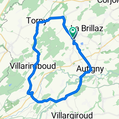
 Route de Villarimboud 13, Torny-le-Grand à Route de Villarimboud 13, Torny-le-Grand
- Distance
- 15.5 km
- Ascent
- 231 m
- Descent
- 232 m
- Location
- Villaz-Saint-Pierre, Canton of Fribourg, Switzerland
 Short ride through Le Glèbe
- Distance
- 0.1 km
- Ascent
- 5 m
- Descent
- 0 m
- Location
- Villaz-Saint-Pierre, Canton of Fribourg, Switzerland
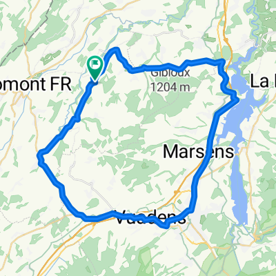 (Au)Tour du Gibloux
- Distance
- 42.5 km
- Ascent
- 375 m
- Descent
- 376 m
- Location
- Villaz-Saint-Pierre, Canton of Fribourg, Switzerland
 Lentigny - Villaz St Pierre - Torny
- Distance
- 20.4 km
- Ascent
- 309 m
- Descent
- 305 m
- Location
- Villaz-Saint-Pierre, Canton of Fribourg, Switzerland
Open it in the app