Maxpulse - TdF - Stage 10 - Andorra
- 1.7 km
- 138 m
- 48 m
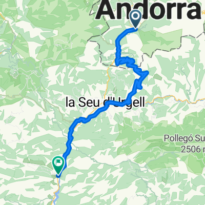
- Les Escaldes, Escaldes-Engordany, Andorra
A cycling route starting in Les Escaldes, Escaldes-Engordany, Andorra.
Overview
Andorra la Vella - Puigcerdà - Masella 115 km if we visit the Spanish enclave, otherwise 92 km; a day of medium difficulty.
created this 9 years ago
Route quality
Quiet road
32.3 km
(28 %)
Track
24.2 km
(21 %)
Paved
57.7 km
(50 %)
Unpaved
18.5 km
(16 %)
Asphalt
56.5 km
(49 %)
Ground
13.8 km
(12 %)
Continue with Bikemap
You would like to ride JS B2B 2017 X etapp Püreneedes or customize it for your own trip? Here is what you can do with this Bikemap route:
Free trial for 3 days, or one-time payment. More about Bikemap Premium.
Discover more Premium features.
Get Bikemap PremiumFrom our community
Open it in the app