

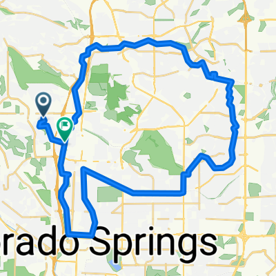
America the Beautiful to Fountain
A cycling route starting in Colorado Springs, Colorado, United States.
Overview
About this route
Mixed paved and unpaved surface. Endurance to MTB
- -:--
- Duration
- 47.3 km
- Distance
- 140 m
- Ascent
- 140 m
- Descent
- ---
- Avg. speed
- ---
- Max. altitude
Route quality
Waytypes & surfaces along the route
Waytypes
Path
34 km
(72 %)
Cycleway
6.1 km
(13 %)
Surfaces
Paved
9.9 km
(21 %)
Unpaved
30.7 km
(65 %)
Unpaved (undefined)
17 km
(36 %)
Gravel
12.8 km
(27 %)
Continue with Bikemap
Use, edit, or download this cycling route
You would like to ride America the Beautiful to Fountain or customize it for your own trip? Here is what you can do with this Bikemap route:
Free features
- Save this route as favorite or in collections
- Copy & plan your own version of this route
- Sync your route with Garmin or Wahoo
Premium features
Free trial for 3 days, or one-time payment. More about Bikemap Premium.
- Navigate this route on iOS & Android
- Export a GPX / KML file of this route
- Create your custom printout (try it for free)
- Download this route for offline navigation
Discover more Premium features.
Get Bikemap PremiumFrom our community
Other popular routes starting in Colorado Springs
 lunch ride paved old stage
- Distance
- 13.7 km
- Ascent
- 298 m
- Descent
- 297 m
- Location
- Colorado Springs, Colorado, United States
 north trail
- Distance
- 49.2 km
- Ascent
- 469 m
- Descent
- 472 m
- Location
- Colorado Springs, Colorado, United States
 Pueblo fifty
- Distance
- 81.2 km
- Ascent
- 35 m
- Descent
- 501 m
- Location
- Colorado Springs, Colorado, United States
 Homestead loop
- Distance
- 44.8 km
- Ascent
- 299 m
- Descent
- 355 m
- Location
- Colorado Springs, Colorado, United States
 Fundraise Ride Day 3 - 50 mi
- Distance
- 80.3 km
- Ascent
- 880 m
- Descent
- 879 m
- Location
- Colorado Springs, Colorado, United States
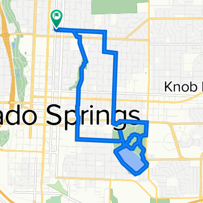 mid shooks run with hill
- Distance
- 13.2 km
- Ascent
- 107 m
- Descent
- 106 m
- Location
- Colorado Springs, Colorado, United States
 lunch ride gold camp
- Distance
- 17 km
- Ascent
- 345 m
- Descent
- 347 m
- Location
- Colorado Springs, Colorado, United States
 Rockrimmon, Colorado Springs to Rockrimmon, Colorado Springs
- Distance
- 8.8 km
- Ascent
- 172 m
- Descent
- 174 m
- Location
- Colorado Springs, Colorado, United States
Open it in the app