E/// Evening 1
A cycling route starting in West End, England, United Kingdom.
Overview
About this route
- -:--
- Duration
- 89.6 km
- Distance
- 734 m
- Ascent
- 734 m
- Descent
- ---
- Avg. speed
- ---
- Avg. speed
Route quality
Waytypes & surfaces along the route
Waytypes
Quiet road
56.2 km
(63 %)
Road
13.2 km
(15 %)
Surfaces
Paved
56 km
(62 %)
Unpaved
0.2 km
(<1 %)
Asphalt
54.1 km
(60 %)
Paved (undefined)
1.8 km
(2 %)
Continue with Bikemap
Use, edit, or download this cycling route
You would like to ride E/// Evening 1 or customize it for your own trip? Here is what you can do with this Bikemap route:
Free features
- Save this route as favorite or in collections
- Copy & plan your own version of this route
- Sync your route with Garmin or Wahoo
Premium features
Free trial for 3 days, or one-time payment. More about Bikemap Premium.
- Navigate this route on iOS & Android
- Export a GPX / KML file of this route
- Create your custom printout (try it for free)
- Download this route for offline navigation
Discover more Premium features.
Get Bikemap PremiumFrom our community
Other popular routes starting in West End
- Long ride through East Dorset near Fordingbridge & Hyde New Forest.
- Distance
- 326.3 km
- Ascent
- 630 m
- Descent
- 608 m
- Location
- West End, England, United Kingdom
- E/// Evening 1
- Distance
- 89.6 km
- Ascent
- 734 m
- Descent
- 734 m
- Location
- West End, England, United Kingdom
- 1 Onibury Close, Southampton to Thornhill Road, Southampton
- Distance
- 5.8 km
- Ascent
- 77 m
- Descent
- 76 m
- Location
- West End, England, United Kingdom
- 29 Maple Road, Southampton to 29 Maple Road, Southampton
- Distance
- 14.4 km
- Ascent
- 0 m
- Descent
- 12 m
- Location
- West End, England, United Kingdom
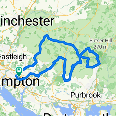
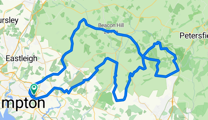
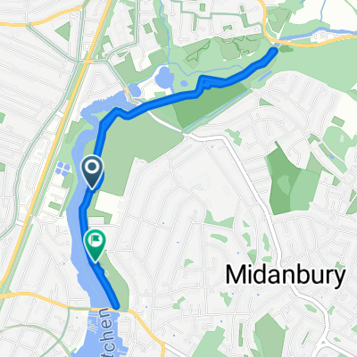
- Restful route in Southampton
- Distance
- 12.5 km
- Ascent
- 10 m
- Descent
- 64 m
- Location
- West End, England, United Kingdom
- Steady ride in United Kingdom
- Distance
- 0.6 km
- Ascent
- 0 m
- Descent
- 0 m
- Location
- West End, England, United Kingdom
- Winchester via Twyford back via Otterbourne
- Distance
- 39.8 km
- Ascent
- 281 m
- Descent
- 280 m
- Location
- West End, England, United Kingdom
- 30.7 mile route
- Distance
- 30.7 km
- Ascent
- 214 m
- Descent
- 207 m
- Location
- West End, England, United Kingdom
Open it in the app