Niederfeldsee
A cycling route starting in Duisburg, North Rhine-Westphalia, Germany.
Overview
About this route
On the 'fast cycling route' from Duisburg, Mülheim, Essen North to Niederfeldsee. For the construction of the lake, parts of the decommissioned embankment of the former 'Rheinische Bahn' were removed and the districts of Altendorf and Bocholt were reconnected. A bike and pedestrian path was developed along the route of the 'Rheinische Bahn' by the RVR (Regional Association of Ruhr).
- -:--
- Duration
- 60.7 km
- Distance
- 143 m
- Ascent
- 144 m
- Descent
- ---
- Avg. speed
- ---
- Max. altitude
Route quality
Waytypes & surfaces along the route
Waytypes
Path
23.7 km
(39 %)
Quiet road
9.1 km
(15 %)
Surfaces
Paved
32.2 km
(53 %)
Unpaved
17 km
(28 %)
Asphalt
32.2 km
(53 %)
Gravel
13.4 km
(22 %)
Route highlights
Points of interest along the route
Photo after 3.1 km
Duisburger Stadtwald
Photo after 11.5 km
Eiscafé Plati Auf dem Dudel 24, 45468 Mülheim an der Ruhr Telefon:0208 31947
Photo after 18.2 km
Radweg Rheinische Bahn RS1
Photo after 21.5 km
Niederfeldsee

Accommodation after 27 km
Parkrestaurant Spindelmann Palmbuschweg 57, 45326 Essen Telefon: 0201 344845 Öffnungszeiten: Samstag, 11:30–15:00, 17:00–23:00

Photo after 28.1 km
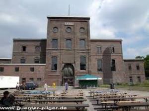
Die Zeche Carl war ein Steinkohlen-Bergwerk im Essener Stadtteil Altenessen.
Photo after 47.4 km
Bahntrassenradeln NW 3.01b: Grüner Pfad, Duisburg-Meiderich – Oberhausen
Continue with Bikemap
Use, edit, or download this cycling route
You would like to ride Niederfeldsee or customize it for your own trip? Here is what you can do with this Bikemap route:
Free features
- Save this route as favorite or in collections
- Copy & plan your own version of this route
- Sync your route with Garmin or Wahoo
Premium features
Free trial for 3 days, or one-time payment. More about Bikemap Premium.
- Navigate this route on iOS & Android
- Export a GPX / KML file of this route
- Create your custom printout (try it for free)
- Download this route for offline navigation
Discover more Premium features.
Get Bikemap PremiumFrom our community
Other popular routes starting in Duisburg
 Baldeney-See Radtour
- Distance
- 62.3 km
- Ascent
- 181 m
- Descent
- 129 m
- Location
- Duisburg, North Rhine-Westphalia, Germany
 RUHRPOTT-TOUR 2010
- Distance
- 50.8 km
- Ascent
- 223 m
- Descent
- 197 m
- Location
- Duisburg, North Rhine-Westphalia, Germany
 Duisburg Neudorf -> Burg Linn
- Distance
- 18.6 km
- Ascent
- 37 m
- Descent
- 44 m
- Location
- Duisburg, North Rhine-Westphalia, Germany
 Durch den Duisburger Stadtwald
- Distance
- 22.9 km
- Ascent
- 192 m
- Descent
- 189 m
- Location
- Duisburg, North Rhine-Westphalia, Germany
 Duisburg Rhein Ruhr
- Distance
- 38.2 km
- Ascent
- 79 m
- Descent
- 79 m
- Location
- Duisburg, North Rhine-Westphalia, Germany
 DuisburgHBH,
- Distance
- 45 km
- Ascent
- 91 m
- Descent
- 88 m
- Location
- Duisburg, North Rhine-Westphalia, Germany
 Duisburg Tour über Orsoy
- Distance
- 62.9 km
- Ascent
- 129 m
- Descent
- 129 m
- Location
- Duisburg, North Rhine-Westphalia, Germany
 DU-Neudorf -> Uettsheimer See
- Distance
- 11.3 km
- Ascent
- 64 m
- Descent
- 74 m
- Location
- Duisburg, North Rhine-Westphalia, Germany
Open it in the app


