

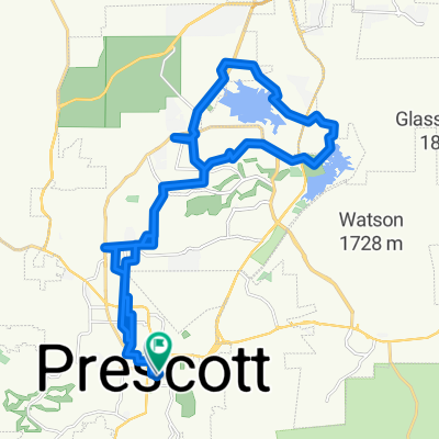
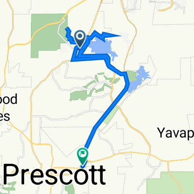
usatesttrackPrescott
A cycling route starting in Prescott, Arizona, United States.
Overview
About this route
afoaisfswghfrqewghrjewvghjrqegewgpihjer4ejoibvgriw
- -:--
- Duration
- 2.3 km
- Distance
- 30 m
- Ascent
- 32 m
- Descent
- ---
- Avg. speed
- ---
- Max. altitude
Route quality
Waytypes & surfaces along the route
Waytypes
Quiet road
1.3 km
(56 %)
Road
0.3 km
(14 %)
Continue with Bikemap
Use, edit, or download this cycling route
You would like to ride usatesttrackPrescott or customize it for your own trip? Here is what you can do with this Bikemap route:
Free features
- Save this route as favorite or in collections
- Copy & plan your own version of this route
- Sync your route with Garmin or Wahoo
Premium features
Free trial for 3 days, or one-time payment. More about Bikemap Premium.
- Navigate this route on iOS & Android
- Export a GPX / KML file of this route
- Create your custom printout (try it for free)
- Download this route for offline navigation
Discover more Premium features.
Get Bikemap PremiumFrom our community
Other popular routes starting in Prescott
 Recovered Route
- Distance
- 82 km
- Ascent
- 2,496 m
- Descent
- 2,450 m
- Location
- Prescott, Arizona, United States
 Route to Watson Lake
- Distance
- 34.2 km
- Ascent
- 518 m
- Descent
- 518 m
- Location
- Prescott, Arizona, United States
 poo poo head
- Distance
- 32.4 km
- Ascent
- 380 m
- Descent
- 244 m
- Location
- Prescott, Arizona, United States
 516 Frederick Ln, Prescott to Quail Loop, Cottonwood
- Distance
- 72.2 km
- Ascent
- 1,024 m
- Descent
- 1,689 m
- Location
- Prescott, Arizona, United States
 34.553° N -112.520° W to 34.552° N -112.521° W
- Distance
- 9.5 km
- Ascent
- 196 m
- Descent
- 206 m
- Location
- Prescott, Arizona, United States
 Willow Creek Park, Prescott to SR-89 S, Prescott
- Distance
- 32.2 km
- Ascent
- 264 m
- Descent
- 186 m
- Location
- Prescott, Arizona, United States
 TS07-TS08
- Distance
- 87.6 km
- Ascent
- 726 m
- Descent
- 1,428 m
- Location
- Prescott, Arizona, United States
 Day 27 CLONED FROM ROUTE 955359
- Distance
- 216.6 km
- Ascent
- 619 m
- Descent
- 1,985 m
- Location
- Prescott, Arizona, United States
Open it in the app