

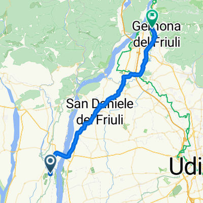
ProvaTilimentDaSanGiorgioRich
A cycling route starting in San Giorgio della Richinvelda, Friuli Venezia Giulia, Italy.
Overview
About this route
Ritrovo con gli altri a Lestans o Borgo Impiano
- -:--
- Duration
- 83.2 km
- Distance
- 1,418 m
- Ascent
- 1,417 m
- Descent
- ---
- Avg. speed
- ---
- Max. altitude

Route quality
Waytypes & surfaces along the route
Waytypes
Quiet road
29.9 km
(36 %)
Track
20.8 km
(25 %)
Surfaces
Paved
29.6 km
(36 %)
Unpaved
7.9 km
(9 %)
Asphalt
28.6 km
(34 %)
Ground
3.8 km
(5 %)
Continue with Bikemap
Use, edit, or download this cycling route
You would like to ride ProvaTilimentDaSanGiorgioRich or customize it for your own trip? Here is what you can do with this Bikemap route:
Free features
- Save this route as favorite or in collections
- Copy & plan your own version of this route
- Split it into stages to create a multi-day tour
- Sync your route with Garmin or Wahoo
Premium features
Free trial for 3 days, or one-time payment. More about Bikemap Premium.
- Navigate this route on iOS & Android
- Export a GPX / KML file of this route
- Create your custom printout (try it for free)
- Download this route for offline navigation
Discover more Premium features.
Get Bikemap PremiumFrom our community
Other popular routes starting in San Giorgio della Richinvelda
 Til_2016
- Distance
- 87.7 km
- Ascent
- 1,425 m
- Descent
- 1,423 m
- Location
- San Giorgio della Richinvelda, Friuli Venezia Giulia, Italy
 ProvaTilimentDaSanGiorgioRich
- Distance
- 83.2 km
- Ascent
- 1,418 m
- Descent
- 1,417 m
- Location
- San Giorgio della Richinvelda, Friuli Venezia Giulia, Italy
 Da Via Sopraorti 13, San Giorgio della Richinvelda a Via Sopraorti 13, San Giorgio della Richinvelda
- Distance
- 18.8 km
- Ascent
- 85 m
- Descent
- 72 m
- Location
- San Giorgio della Richinvelda, Friuli Venezia Giulia, Italy
 Da Via della Colonia, San Giorgio della Richinvelda a Via Sopraorti 13, San Giorgio della Richinvelda
- Distance
- 19.9 km
- Ascent
- 68 m
- Descent
- 55 m
- Location
- San Giorgio della Richinvelda, Friuli Venezia Giulia, Italy
 tagliamento-campeggio
- Distance
- 40.1 km
- Ascent
- 253 m
- Descent
- 122 m
- Location
- San Giorgio della Richinvelda, Friuli Venezia Giulia, Italy
 Via Stazione 19, San Giorgio della Richinvelda nach Via Giuseppe Garibaldi 57, Portogruaro
- Distance
- 37.1 km
- Ascent
- 7 m
- Descent
- 89 m
- Location
- San Giorgio della Richinvelda, Friuli Venezia Giulia, Italy
 Monte di Muris
- Distance
- 47.7 km
- Ascent
- 489 m
- Descent
- 489 m
- Location
- San Giorgio della Richinvelda, Friuli Venezia Giulia, Italy
 Da Piazza Beato Bertrando 2, San Giorgio della Richinvelda a Via Sopra Orti 19, San Giorgio della Richinvelda
- Distance
- 13.7 km
- Ascent
- 49 m
- Descent
- 72 m
- Location
- San Giorgio della Richinvelda, Friuli Venezia Giulia, Italy
Open it in the app