

Camino Primitivo Fra kysten til Lugo
A cycling route starting in Villaviciosa, Principality of Asturias, Spain.
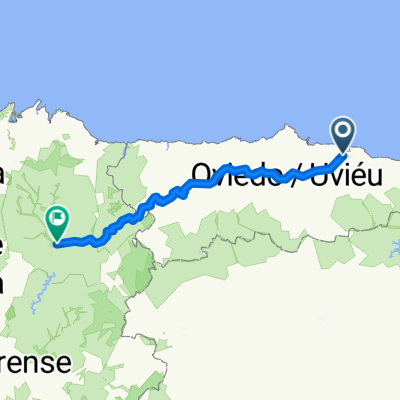
Overview
About this route
Forsøk på track av caminoen 270 km hit
- -:--
- Duration
- 270 km
- Distance
- 2,891 m
- Ascent
- 2,492 m
- Descent
- ---
- Avg. speed
- ---
- Max. altitude

Route quality
Waytypes & surfaces along the route
Waytypes
Quiet road
62.1 km
(23 %)
Road
54 km
(20 %)
Surfaces
Paved
143.1 km
(53 %)
Unpaved
18.9 km
(7 %)
Asphalt
143.1 km
(53 %)
Gravel
10.8 km
(4 %)
Continue with Bikemap
Use, edit, or download this cycling route
You would like to ride Camino Primitivo Fra kysten til Lugo or customize it for your own trip? Here is what you can do with this Bikemap route:
Free features
- Save this route as favorite or in collections
- Copy & plan your own version of this route
- Split it into stages to create a multi-day tour
- Sync your route with Garmin or Wahoo
Premium features
Free trial for 3 days, or one-time payment. More about Bikemap Premium.
- Navigate this route on iOS & Android
- Export a GPX / KML file of this route
- Create your custom printout (try it for free)
- Download this route for offline navigation
Discover more Premium features.
Get Bikemap PremiumFrom our community
Other popular routes starting in Villaviciosa
 From Villaviciosa to Oviedo
- Distance
- 48.5 km
- Ascent
- 1,223 m
- Descent
- 990 m
- Location
- Villaviciosa, Principality of Asturias, Spain
 Villaviciosa - Alto de La Llama
- Distance
- 188.2 km
- Ascent
- 3,277 m
- Descent
- 2,877 m
- Location
- Villaviciosa, Principality of Asturias, Spain
 El Puntal
- Distance
- 15.3 km
- Ascent
- 42 m
- Descent
- 42 m
- Location
- Villaviciosa, Principality of Asturias, Spain
 2005 (Excursión - Villaviciosa)
- Distance
- 87.5 km
- Ascent
- 1,099 m
- Descent
- 1,096 m
- Location
- Villaviciosa, Principality of Asturias, Spain
 Valdediós y Bozanes
- Distance
- 20 km
- Ascent
- 238 m
- Descent
- 240 m
- Location
- Villaviciosa, Principality of Asturias, Spain
 Selorio-Lastres-Colunga
- Distance
- 25.2 km
- Ascent
- 494 m
- Descent
- 370 m
- Location
- Villaviciosa, Principality of Asturias, Spain
 Villaviciosa
- Distance
- 85.2 km
- Ascent
- 1,054 m
- Descent
- 1,052 m
- Location
- Villaviciosa, Principality of Asturias, Spain
 Camino Primitivo Fra kysten til Lugo
- Distance
- 270 km
- Ascent
- 2,891 m
- Descent
- 2,492 m
- Location
- Villaviciosa, Principality of Asturias, Spain
Open it in the app