Wielka wyprawa 03
- 299.9 km
- 879 m
- 768 m
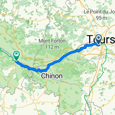
- Joué-lès-Tours, Centre-Val de Loire, France
A cycling route starting in Joué-lès-Tours, Centre-Val de Loire, France.
Overview
Route quality
Road
185.6 km
(43 %)
Quiet road
95 km
(22 %)
Paved
112.2 km
(26 %)
Asphalt
112.2 km
(26 %)
Undefined
319.5 km
(74 %)
Route highlights
Le chateau de Betz-le-Chateau
Laiterie de Verneuil
Musée d'archéologie
La Claise
-Les thermes et sources -Porte du 12 éme siècle, rue de Bourbon -Abbaye cistercienne
La Creuse
Eglise Saint léger du 12éme siècle
-Elu un des "Plus beaux villages de France" -Le chateau -Le roc aux sorciers -La maison du tourisme -La Huche Corne -La maison du Cardinal La Balarue
Abbaye
La Creuse
-Ecomusée 14h-18h
-Marché le mercredi matin -Boutiques de livres et bouquineries (il y en a des dizaines dans le village...)
Le Roc d'enfer -Marché le mardi matin
La Vienne
Marché et foire le 12 de chaque mois, foire aux animaux le 12 Avril.
La Vienne
Le village !
-Parc du Périgord -Flèche de l' église -Musée de la météorite
-Les fontaines guerisseuses
-Les couteaux de Nontron
-Le dolmen -Le chateau
Continue with Bikemap
You would like to ride Tours-Périgueux touristique or customize it for your own trip? Here is what you can do with this Bikemap route:
Free trial for 3 days, or one-time payment. More about Bikemap Premium.
Discover more Premium features.
Get Bikemap PremiumFrom our community
Open it in the app