ASDF
- 118 km
- 3,407 m
- 2,021 m
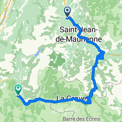
- Saint-Etienne-de-Cuines, Auvergne-Rhône-Alpes, France
A cycling route starting in Saint-Etienne-de-Cuines, Auvergne-Rhône-Alpes, France.
Overview
Montarlot - Pontamafrey - Col du Chaussy - Pontamafrey - Montarlot
created this 10 years ago
Route quality
Road
28.6 km
69 %
Quiet road
2.1 km
5 %
Undefined
10.8 km
26 %
Paved
23.6 km
(57 %)
Asphalt
23.6 km
57 %
Undefined
17.8 km
43 %
Continue with Bikemap
You would like to ride Montarlot 2 juni 2007 or customize it for your own trip? Here is what you can do with this Bikemap route:
Free trial for 3 days, or one-time payment. More about Bikemap Premium.
Discover more Premium features.
Get Bikemap PremiumFrom our community
Open it in the app