

Kokkola-Ylihärmä
A cycling route starting in Kokkola, Central Ostrobothnia, Finland.
Overview
About this route
SF Tour Day 1 Sunday 3. July 2016
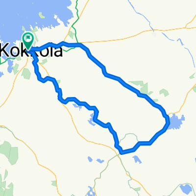
Kokkola - Ylihärmä
- -:--
- Duration
- 111.1 km
- Distance
- 73 m
- Ascent
- 37 m
- Descent
- ---
- Avg. speed
- ---
- Max. altitude

Route quality
Waytypes & surfaces along the route
Waytypes
Road
46.2 km
(42 %)
Cycleway
44.5 km
(40 %)
Surfaces
Paved
81.1 km
(73 %)
Unpaved
6.8 km
(6 %)
Paved (undefined)
41 km
(37 %)
Asphalt
39.7 km
(36 %)
Continue with Bikemap
Use, edit, or download this cycling route
You would like to ride Kokkola-Ylihärmä or customize it for your own trip? Here is what you can do with this Bikemap route:
Free features
- Save this route as favorite or in collections
- Copy & plan your own version of this route
- Split it into stages to create a multi-day tour
- Sync your route with Garmin or Wahoo
Premium features
Free trial for 3 days, or one-time payment. More about Bikemap Premium.
- Navigate this route on iOS & Android
- Export a GPX / KML file of this route
- Create your custom printout (try it for free)
- Download this route for offline navigation
Discover more Premium features.
Get Bikemap PremiumFrom our community
Other popular routes starting in Kokkola
 Sateenkaari - Saarenkangas
- Distance
- 29.5 km
- Ascent
- 16 m
- Descent
- 16 m
- Location
- Kokkola, Central Ostrobothnia, Finland
 Laajalahti
- Distance
- 21.1 km
- Ascent
- 24 m
- Descent
- 22 m
- Location
- Kokkola, Central Ostrobothnia, Finland
 0043 EuroVelo 10 Day 26
- Distance
- 85.2 km
- Ascent
- 69 m
- Descent
- 69 m
- Location
- Kokkola, Central Ostrobothnia, Finland
 Nauti merituulesta ja saaristomaisemista Öjan pyöräilyreitillä - Nauti merituulesta ja saaristomaisemista Öjan pyöräilyreitillä
- Distance
- 36.1 km
- Ascent
- 150 m
- Descent
- 148 m
- Location
- Kokkola, Central Ostrobothnia, Finland
 Kokkola-Ylihärmä
- Distance
- 111.1 km
- Ascent
- 73 m
- Descent
- 37 m
- Location
- Kokkola, Central Ostrobothnia, Finland
 Kokkola-Sokoja-Merijärv-Humla-Lappfors-Evijärvi-Långvatten-Terjärv-Nedervetil-Kokkola
- Distance
- 167.3 km
- Ascent
- 123 m
- Descent
- 124 m
- Location
- Kokkola, Central Ostrobothnia, Finland
 Kokkola-Seljes-Kaustinen-Ullava-Kälviä-Kokkola
- Distance
- 135 km
- Ascent
- 191 m
- Descent
- 186 m
- Location
- Kokkola, Central Ostrobothnia, Finland
 Santahaka-Harriniemi-Kvikant
- Distance
- 24.5 km
- Ascent
- 4 m
- Descent
- 6 m
- Location
- Kokkola, Central Ostrobothnia, Finland
Open it in the app