

Fort 49 do fort mistrzejowice
A cycling route starting in Michałowice, Lesser Poland Voivodeship, Poland.
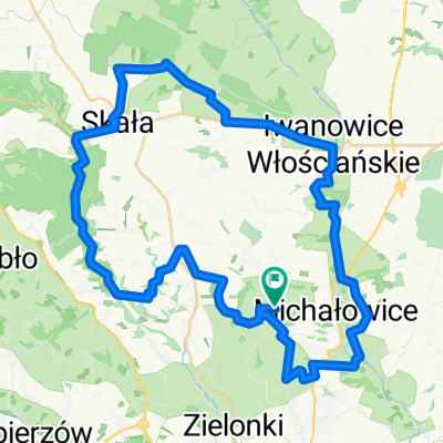
Overview
About this route
- 5 h 25 min
- Duration
- 20.2 km
- Distance
- 138 m
- Ascent
- 138 m
- Descent
- 3.7 km/h
- Avg. speed
- ---
- Max. altitude

Route photos

Route quality
Waytypes & surfaces along the route
Waytypes
Pedestrian area
12 km
(59 %)
Quiet road
2.6 km
(13 %)
Surfaces
Paved
15.9 km
(79 %)
Unpaved
0.5 km
(2 %)
Paving stones
6.8 km
(34 %)
Asphalt
6.6 km
(33 %)
Continue with Bikemap
Use, edit, or download this cycling route
You would like to ride Fort 49 do fort mistrzejowice or customize it for your own trip? Here is what you can do with this Bikemap route:
Free features
- Save this route as favorite or in collections
- Copy & plan your own version of this route
- Sync your route with Garmin or Wahoo
Premium features
Free trial for 3 days, or one-time payment. More about Bikemap Premium.
- Navigate this route on iOS & Android
- Export a GPX / KML file of this route
- Create your custom printout (try it for free)
- Download this route for offline navigation
Discover more Premium features.
Get Bikemap PremiumFrom our community
Other popular routes starting in Michałowice
 Mistrzejowice-bibice-zielonki-bronowice
- Distance
- 42.2 km
- Ascent
- 229 m
- Descent
- 228 m
- Location
- Michałowice, Lesser Poland Voivodeship, Poland
 BAŁKANY17
- Distance
- 3,523.4 km
- Ascent
- 6,912 m
- Descent
- 7,015 m
- Location
- Michałowice, Lesser Poland Voivodeship, Poland
 Route to Leśna 127, 32-091 Michałowice
- Distance
- 55.6 km
- Ascent
- 879 m
- Descent
- 880 m
- Location
- Michałowice, Lesser Poland Voivodeship, Poland
 KRK: NH -> Ojców -> Będkowska -> Kleszczów -> Mydlniki -> NH
- Distance
- 81.8 km
- Ascent
- 548 m
- Descent
- 548 m
- Location
- Michałowice, Lesser Poland Voivodeship, Poland
 Raciborowice - Michałowice
- Distance
- 13.3 km
- Ascent
- 190 m
- Descent
- 180 m
- Location
- Michałowice, Lesser Poland Voivodeship, Poland
 Bibice dłubnia
- Distance
- 20.4 km
- Ascent
- 205 m
- Descent
- 208 m
- Location
- Michałowice, Lesser Poland Voivodeship, Poland
 Zielona trasa rowerowa
- Distance
- 22.5 km
- Ascent
- 269 m
- Descent
- 269 m
- Location
- Michałowice, Lesser Poland Voivodeship, Poland
 osada jurajska
- Distance
- 27.1 km
- Ascent
- 157 m
- Descent
- 175 m
- Location
- Michałowice, Lesser Poland Voivodeship, Poland
Open it in the app