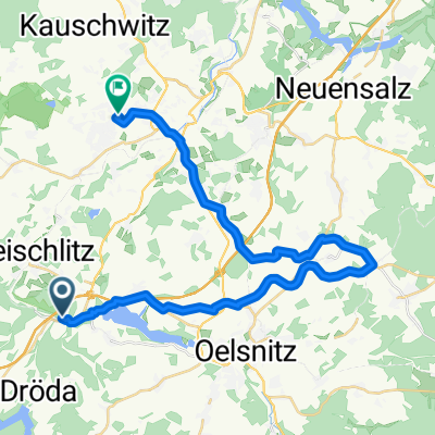
1. und 2 BA des Radweges Oelsnitz Falkenstein (alte Bahnlinie).
- 28.3 km
- 312 m
- 280 m
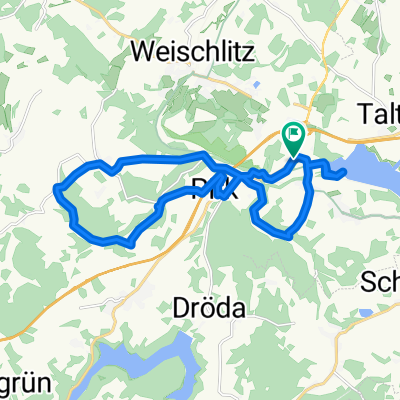
- Weischlitz, Saxony, Germany
My first route posted here. About 650-700 meters of elevation gain, for MTB or cyclocross bike. Points of interest: Kemmler, SR2 monument in Kürbitz, view into the Elstertal with bridge (Geilsdorf), quiet spot, trail along the Pirk. Have fun!
Track
15.9 km39 %Quiet road
9.8 km24 %Paved
10.2 km(25 %)Unpaved
17.5 km(43 %)Asphalt
10.2 km25 %Gravel
6.9 km17 %Free trial for 3 days, or one-time payment. More about Bikemap Premium.
Discover more Premium features.
Get Bikemap PremiumOpen it in the app