

Toni: Volksmarch 2009
A cycling route starting in Filderstadt, Baden-Wurttemberg, Germany.
Overview
About this route
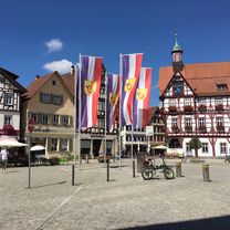
A great volksmarch, with a stop for a drink at Uhlbergturm and coffee and cake at the Filderklinic. There are several challenging inclines to scale. Enjoy!
- -:--
- Duration
- 9.5 km
- Distance
- 194 m
- Ascent
- 154 m
- Descent
- ---
- Avg. speed
- 474 m
- Max. altitude
Route quality
Waytypes & surfaces along the route
Waytypes
Track
6.4 km
(67 %)
Quiet road
2.2 km
(23 %)
Surfaces
Paved
3.5 km
(37 %)
Unpaved
4.9 km
(52 %)
Asphalt
2.9 km
(31 %)
Gravel
2.7 km
(28 %)
Continue with Bikemap
Use, edit, or download this cycling route
You would like to ride Toni: Volksmarch 2009 or customize it for your own trip? Here is what you can do with this Bikemap route:
Free features
- Save this route as favorite or in collections
- Copy & plan your own version of this route
- Sync your route with Garmin or Wahoo
Premium features
Free trial for 3 days, or one-time payment. More about Bikemap Premium.
- Navigate this route on iOS & Android
- Export a GPX / KML file of this route
- Create your custom printout (try it for free)
- Download this route for offline navigation
Discover more Premium features.
Get Bikemap PremiumFrom our community
Other popular routes starting in Filderstadt
 Dettenhausen Uhlberturm Runde
- Distance
- 23 km
- Ascent
- 485 m
- Descent
- 485 m
- Location
- Filderstadt, Baden-Wurttemberg, Germany
 Aichtal über Dettenhausen zurück
- Distance
- 51.9 km
- Ascent
- 490 m
- Descent
- 487 m
- Location
- Filderstadt, Baden-Wurttemberg, Germany
 Aichtal_Waldenbuch_Sieben_Mühlen
- Distance
- 50.4 km
- Ascent
- 578 m
- Descent
- 534 m
- Location
- Filderstadt, Baden-Wurttemberg, Germany
 Körschtal - Deizisau - Sauhag
- Distance
- 49.9 km
- Ascent
- 426 m
- Descent
- 493 m
- Location
- Filderstadt, Baden-Wurttemberg, Germany
 Walddorfhäslach - Dettenhausen
- Distance
- 36.9 km
- Ascent
- 476 m
- Descent
- 485 m
- Location
- Filderstadt, Baden-Wurttemberg, Germany
 CR NH Tübingen NH 72
- Distance
- 71.8 km
- Ascent
- 452 m
- Descent
- 452 m
- Location
- Filderstadt, Baden-Wurttemberg, Germany
 Nach Urach und zurück
- Distance
- 64.5 km
- Ascent
- 713 m
- Descent
- 711 m
- Location
- Filderstadt, Baden-Wurttemberg, Germany
 Filder-Körschtal-Runde
- Distance
- 20.7 km
- Ascent
- 172 m
- Descent
- 181 m
- Location
- Filderstadt, Baden-Wurttemberg, Germany
Open it in the app