

zug von berlin und vile schlaubetal
A cycling route starting in Mixdorf, Brandenburg, Germany.
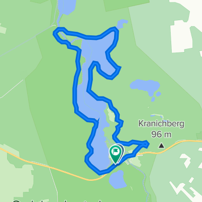
Overview
About this route
extremly beautiful
- -:--
- Duration
- 38.7 km
- Distance
- 130 m
- Ascent
- 154 m
- Descent
- ---
- Avg. speed
- ---
- Max. altitude
Route quality
Waytypes & surfaces along the route
Waytypes
Path
19.4 km
(50 %)
Track
10.1 km
(26 %)
Surfaces
Paved
17 km
(44 %)
Unpaved
17.8 km
(46 %)
Asphalt
16.3 km
(42 %)
Ground
13.9 km
(36 %)
Continue with Bikemap
Use, edit, or download this cycling route
You would like to ride zug von berlin und vile schlaubetal or customize it for your own trip? Here is what you can do with this Bikemap route:
Free features
- Save this route as favorite or in collections
- Copy & plan your own version of this route
- Sync your route with Garmin or Wahoo
Premium features
Free trial for 3 days, or one-time payment. More about Bikemap Premium.
- Navigate this route on iOS & Android
- Export a GPX / KML file of this route
- Create your custom printout (try it for free)
- Download this route for offline navigation
Discover more Premium features.
Get Bikemap PremiumFrom our community
Other popular routes starting in Mixdorf
 Bremsdorfer Mühle 5, Schlaubetal nach Bremsdorfer Mühle 5, Schlaubetal
- Distance
- 12 km
- Ascent
- 95 m
- Descent
- 88 m
- Location
- Mixdorf, Brandenburg, Germany
 Raftour 2016
- Distance
- 68.8 km
- Ascent
- 202 m
- Descent
- 206 m
- Location
- Mixdorf, Brandenburg, Germany
 Route in Siehdichum
- Distance
- 25.7 km
- Ascent
- 248 m
- Descent
- 247 m
- Location
- Mixdorf, Brandenburg, Germany
 Runde um den Jacobsee
- Distance
- 33.2 km
- Ascent
- 181 m
- Descent
- 179 m
- Location
- Mixdorf, Brandenburg, Germany
 29.09.2013 Schlaubetal
- Distance
- 36.5 km
- Ascent
- 217 m
- Descent
- 216 m
- Location
- Mixdorf, Brandenburg, Germany
 17.03.2012 Schlaubetal Xtreme
- Distance
- 38.3 km
- Ascent
- 201 m
- Descent
- 200 m
- Location
- Mixdorf, Brandenburg, Germany
 28 km Rund um die Bremsdorfer Mühle
- Distance
- 26.4 km
- Ascent
- 177 m
- Descent
- 212 m
- Location
- Mixdorf, Brandenburg, Germany
 Schernsdorf – Reitwein
- Distance
- 51.3 km
- Ascent
- 203 m
- Descent
- 279 m
- Location
- Mixdorf, Brandenburg, Germany
Open it in the app