
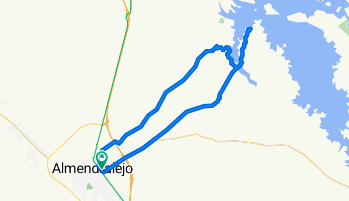
Los Pajares
A cycling route starting in Almendralejo, Extremadura, Spain.
Overview
About this route
Ruta por Tierra de Barros y alrededores
- -:--
- Duration
- 32.6 km
- Distance
- 151 m
- Ascent
- 151 m
- Descent
- ---
- Avg. speed
- ---
- Max. altitude

Route photos

Continue with Bikemap
Use, edit, or download this cycling route
You would like to ride Los Pajares or customize it for your own trip? Here is what you can do with this Bikemap route:
Free features
- Save this route as favorite or in collections
- Copy & plan your own version of this route
- Sync your route with Garmin or Wahoo
Premium features
Free trial for 3 days, or one-time payment. More about Bikemap Premium.
- Navigate this route on iOS & Android
- Export a GPX / KML file of this route
- Create your custom printout (try it for free)
- Download this route for offline navigation
Discover more Premium features.
Get Bikemap PremiumFrom our community
Other popular routes starting in Almendralejo
 Sexmo del Limón
- Distance
- 46.2 km
- Ascent
- 236 m
- Descent
- 236 m
- Location
- Almendralejo, Extremadura, Spain
 Almendralejo-El Morgaño-Almendralejo
- Distance
- 25.7 km
- Ascent
- 125 m
- Descent
- 121 m
- Location
- Almendralejo, Extremadura, Spain
 Pantano de Alange por el Morgaño
- Distance
- 41.5 km
- Ascent
- 197 m
- Descent
- 195 m
- Location
- Almendralejo, Extremadura, Spain
 Ruta Albergue de Peregrinos
- Distance
- 46.7 km
- Ascent
- 174 m
- Descent
- 192 m
- Location
- Almendralejo, Extremadura, Spain
 II MARCHA NOCTURNA EN BTT
- Distance
- 93.4 km
- Ascent
- 255 m
- Descent
- 255 m
- Location
- Almendralejo, Extremadura, Spain
 ALMENDRALEJO-FUENTE DEL MAESTRE-VILLAFRANCA-ALMENDRALEJO
- Distance
- 47.2 km
- Ascent
- 219 m
- Descent
- 220 m
- Location
- Almendralejo, Extremadura, Spain
 Almendralejo-Mérida-Presa de Alange-Almendralejo
- Distance
- 65.4 km
- Ascent
- 218 m
- Descent
- 242 m
- Location
- Almendralejo, Extremadura, Spain
 El Manzo
- Distance
- 36.7 km
- Ascent
- 201 m
- Descent
- 190 m
- Location
- Almendralejo, Extremadura, Spain
Open it in the app