

Zarečki krov / Slap Sopot
A cycling route starting in Pazin, Istria County, Croatia.
Overview
About this route
Heavy climbs (asphalt), mud on winter time on some segments.
- -:--
- Duration
- 39.9 km
- Distance
- 650 m
- Ascent
- 650 m
- Descent
- ---
- Avg. speed
- ---
- Max. altitude
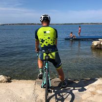
Route photos

Route quality
Waytypes & surfaces along the route
Waytypes
Track
16.4 km
(41 %)
Quiet road
14.4 km
(36 %)
Surfaces
Paved
10 km
(25 %)
Unpaved
4.8 km
(12 %)
Asphalt
7.2 km
(18 %)
Unpaved (undefined)
3.2 km
(8 %)
Continue with Bikemap
Use, edit, or download this cycling route
You would like to ride Zarečki krov / Slap Sopot or customize it for your own trip? Here is what you can do with this Bikemap route:
Free features
- Save this route as favorite or in collections
- Copy & plan your own version of this route
- Sync your route with Garmin or Wahoo
Premium features
Free trial for 3 days, or one-time payment. More about Bikemap Premium.
- Navigate this route on iOS & Android
- Export a GPX / KML file of this route
- Create your custom printout (try it for free)
- Download this route for offline navigation
Discover more Premium features.
Get Bikemap PremiumFrom our community
Other popular routes starting in Pazin
 Tinjan - Limski
- Distance
- 23.5 km
- Ascent
- 286 m
- Descent
- 605 m
- Location
- Pazin, Istria County, Croatia
 RR-Flach: Zminj-Rovinji-Bale-Svetvincenat-Zminj
- Distance
- 64.1 km
- Ascent
- 395 m
- Descent
- 395 m
- Location
- Pazin, Istria County, Croatia
 Vajka blatna
- Distance
- 13.2 km
- Ascent
- 375 m
- Descent
- 375 m
- Location
- Pazin, Istria County, Croatia
 Pazin 1 (Pazin - Tinjan - Kringa - Sv. Petar)
- Distance
- 53.2 km
- Ascent
- 774 m
- Descent
- 774 m
- Location
- Pazin, Istria County, Croatia
 ISTRA MTB Drunk Railroad
- Distance
- 48 km
- Ascent
- 1,042 m
- Descent
- 1,046 m
- Location
- Pazin, Istria County, Croatia
 SC 53 Durch Istriens Hinterland
- Distance
- 136 km
- Ascent
- 2,215 m
- Descent
- 2,221 m
- Location
- Pazin, Istria County, Croatia
 95km MTB: Tinjan - Karojba - Vižinada - Poreč - Vrsar - Barat - Kringa - Tinjan
- Distance
- 94.9 km
- Ascent
- 1,180 m
- Descent
- 1,179 m
- Location
- Pazin, Istria County, Croatia
 Istra Tc day 2
- Distance
- 103.7 km
- Ascent
- 1,471 m
- Descent
- 1,432 m
- Location
- Pazin, Istria County, Croatia
Open it in the app