

Entre Culture et le Monastier
A cycling route starting in Chanac, Occitanie, France.
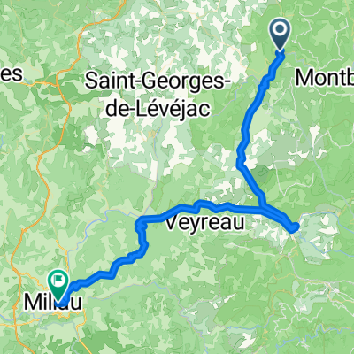
Overview
About this route
Esclanèdes towards Grèzes Palhers Les Bories Les Salelles Le Villard Chanac Esclanèdes
- -:--
- Duration
- 36.7 km
- Distance
- 580 m
- Ascent
- 583 m
- Descent
- ---
- Avg. speed
- ---
- Max. altitude

Route quality
Waytypes & surfaces along the route
Waytypes
Quiet road
17.3 km
(47 %)
Road
4.4 km
(12 %)
Surfaces
Paved
8.1 km
(22 %)
Unpaved
3.7 km
(10 %)
Asphalt
8.1 km
(22 %)
Gravel
3.7 km
(10 %)
Undefined
25 km
(68 %)
Continue with Bikemap
Use, edit, or download this cycling route
You would like to ride Entre Culture et le Monastier or customize it for your own trip? Here is what you can do with this Bikemap route:
Free features
- Save this route as favorite or in collections
- Copy & plan your own version of this route
- Sync your route with Garmin or Wahoo
Premium features
Free trial for 3 days, or one-time payment. More about Bikemap Premium.
- Navigate this route on iOS & Android
- Export a GPX / KML file of this route
- Create your custom printout (try it for free)
- Download this route for offline navigation
Discover more Premium features.
Get Bikemap PremiumFrom our community
Other popular routes starting in Chanac
 F123-2024-Chanac-Correjac-Le Balmes-Chanac
- Distance
- 42.9 km
- Ascent
- 1,243 m
- Descent
- 1,244 m
- Location
- Chanac, Occitanie, France
 Ste. Enimie - Millau (Causse Route nr. 159)
- Distance
- 76.7 km
- Ascent
- 1,119 m
- Descent
- 1,262 m
- Location
- Chanac, Occitanie, France
 F125-2024-Chanac-La Tieule-Chanac
- Distance
- 65.1 km
- Ascent
- 1,794 m
- Descent
- 1,798 m
- Location
- Chanac, Occitanie, France
 F124-2024-Chanac-Einrollen-Trekking
- Distance
- 58.7 km
- Ascent
- 1,670 m
- Descent
- 1,670 m
- Location
- Chanac, Occitanie, France
 F122-2024-Chanac-Florac-Les Vignes-La Malene-Chanac
- Distance
- 118.7 km
- Ascent
- 3,462 m
- Descent
- 3,474 m
- Location
- Chanac, Occitanie, France
 F121-2024-Chanac-Quezac-Saint Emine-Chanac
- Distance
- 63.4 km
- Ascent
- 2,103 m
- Descent
- 2,109 m
- Location
- Chanac, Occitanie, France
 F120-2024-Chanac-Saint Emine-La Malene-Chanac
- Distance
- 61.1 km
- Ascent
- 2,248 m
- Descent
- 2,255 m
- Location
- Chanac, Occitanie, France
 Tarnroute (Nr. 160) Ste. Enemie- Millau
- Distance
- 55.4 km
- Ascent
- 318 m
- Descent
- 436 m
- Location
- Chanac, Occitanie, France
Open it in the app