

Ruta Carretera 18: 111 Km 747 m - "San Martín, Chinchón y Perales"
A cycling route starting in Velilla de San Antonio, Madrid, Spain.
Overview
About this route
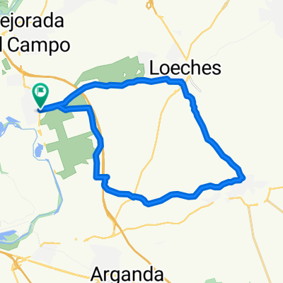
Rivas-Vaciamadrid - Mejorada del Campo - Velilla de San Antonio - La Poveda - San Martín de la Vega - Ciempozuelos - Titulcia - Chinchón - Valdelaguna (R) - Perales de Tajuña - Campo Real - Loeches (F) - Rivas-Vaciamadrid
- -:--
- Duration
- 110.7 km
- Distance
- 600 m
- Ascent
- 602 m
- Descent
- ---
- Avg. speed
- ---
- Max. altitude

Route quality
Waytypes & surfaces along the route
Waytypes
Busy road
67.9 km
(61 %)
Road
17.9 km
(16 %)
Surfaces
Paved
21.2 km
(19 %)
Unpaved
2.4 km
(2 %)
Asphalt
21.2 km
(19 %)
Ground
2.1 km
(2 %)
Continue with Bikemap
Use, edit, or download this cycling route
You would like to ride Ruta Carretera 18: 111 Km 747 m - "San Martín, Chinchón y Perales" or customize it for your own trip? Here is what you can do with this Bikemap route:
Free features
- Save this route as favorite or in collections
- Copy & plan your own version of this route
- Split it into stages to create a multi-day tour
- Sync your route with Garmin or Wahoo
Premium features
Free trial for 3 days, or one-time payment. More about Bikemap Premium.
- Navigate this route on iOS & Android
- Export a GPX / KML file of this route
- Create your custom printout (try it for free)
- Download this route for offline navigation
Discover more Premium features.
Get Bikemap PremiumFrom our community
Other popular routes starting in Velilla de San Antonio
 Velilla - Rivas
- Distance
- 28.3 km
- Ascent
- 204 m
- Descent
- 205 m
- Location
- Velilla de San Antonio, Madrid, Spain
 Ruta Ciclodeportiva 11: 129 Km 1112 m - 'Hontoba y Villar del Olmo' 19
- Distance
- 129.2 km
- Ascent
- 837 m
- Descent
- 839 m
- Location
- Velilla de San Antonio, Madrid, Spain
 De Calle del Laurel, 46, Rivas-Vaciamadrid a Calle del Laurel, 46, Rivas-Vaciamadrid
- Distance
- 4 km
- Ascent
- 39 m
- Descent
- 37 m
- Location
- Velilla de San Antonio, Madrid, Spain
 Velilla - Loeches - Campo Real - Velilla de San Antonio
- Distance
- 24.3 km
- Ascent
- 312 m
- Descent
- 312 m
- Location
- Velilla de San Antonio, Madrid, Spain
 Tramo2
- Distance
- 9 km
- Ascent
- 12 m
- Descent
- 12 m
- Location
- Velilla de San Antonio, Madrid, Spain
 Ruta probando nuevas ruedas 29
- Distance
- 27.7 km
- Ascent
- 317 m
- Descent
- 320 m
- Location
- Velilla de San Antonio, Madrid, Spain
 Velilla de san Antonio a sanfernando de Henares
- Distance
- 16.8 km
- Ascent
- 51 m
- Descent
- 44 m
- Location
- Velilla de San Antonio, Madrid, Spain
 Ruta Ciclodeportiva 01: 116 Km 490 m - 'Aranjuez'
- Distance
- 115.3 km
- Ascent
- 297 m
- Descent
- 298 m
- Location
- Velilla de San Antonio, Madrid, Spain
Open it in the app