

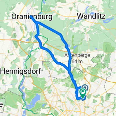
Rundweg-29km-Buchholz-Gorinsee-Mühlenbeck
A cycling route starting in Französisch Buchholz, State of Berlin, Germany.
Overview
About this route
Rundweg-29km-Buchholz-Gorinsee-Mühlenbeck
- -:--
- Duration
- 29.2 km
- Distance
- 75 m
- Ascent
- 74 m
- Descent
- ---
- Avg. speed
- ---
- Max. altitude
Route quality
Waytypes & surfaces along the route
Waytypes
Quiet road
9.1 km
(31 %)
Path
5.8 km
(20 %)
Surfaces
Paved
19.6 km
(67 %)
Unpaved
6.7 km
(23 %)
Asphalt
18.7 km
(64 %)
Loose gravel
5 km
(17 %)
Continue with Bikemap
Use, edit, or download this cycling route
You would like to ride Rundweg-29km-Buchholz-Gorinsee-Mühlenbeck or customize it for your own trip? Here is what you can do with this Bikemap route:
Free features
- Save this route as favorite or in collections
- Copy & plan your own version of this route
- Sync your route with Garmin or Wahoo
Premium features
Free trial for 3 days, or one-time payment. More about Bikemap Premium.
- Navigate this route on iOS & Android
- Export a GPX / KML file of this route
- Create your custom printout (try it for free)
- Download this route for offline navigation
Discover more Premium features.
Get Bikemap PremiumFrom our community
Other popular routes starting in Französisch Buchholz
 Nordberliner 70 km Runde
- Distance
- 67.7 km
- Ascent
- 108 m
- Descent
- 105 m
- Location
- Französisch Buchholz, State of Berlin, Germany
 Berlin Pankow-Werbelinsee Runde 1.6.09
- Distance
- 114.7 km
- Ascent
- 373 m
- Descent
- 368 m
- Location
- Französisch Buchholz, State of Berlin, Germany
 Nordberliner 70 km Runde CLONED FROM ROUTE 227982
- Distance
- 77.9 km
- Ascent
- 108 m
- Descent
- 105 m
- Location
- Französisch Buchholz, State of Berlin, Germany
 Nordberliner 70 km Runde CLONED FROM ROUTE 227982
- Distance
- 67.8 km
- Ascent
- 88 m
- Descent
- 87 m
- Location
- Französisch Buchholz, State of Berlin, Germany
 Galenusstr. - Oranienburg - Galenusstr.
- Distance
- 64 km
- Ascent
- 102 m
- Descent
- 100 m
- Location
- Französisch Buchholz, State of Berlin, Germany
 Pankeweg to Wandlitz
- Distance
- 20.3 km
- Ascent
- 25 m
- Descent
- 12 m
- Location
- Französisch Buchholz, State of Berlin, Germany
 Schönerlinder Straße
- Distance
- 3.5 km
- Ascent
- 8 m
- Descent
- 9 m
- Location
- Französisch Buchholz, State of Berlin, Germany
 20170521_155214.gpx
- Distance
- 24.7 km
- Ascent
- 64 m
- Descent
- 69 m
- Location
- Französisch Buchholz, State of Berlin, Germany
Open it in the app