

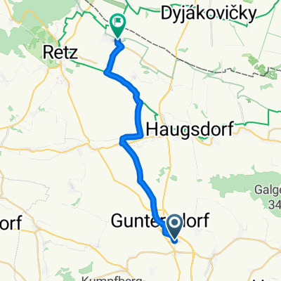
Trainingsrunde
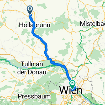
A cycling route starting in Guntersdorf, Lower Austria, Austria.
Overview
About this route
Many elevation meters at various difficulty levels
- -:--
- Duration
- 41.1 km
- Distance
- 573 m
- Ascent
- 541 m
- Descent
- ---
- Avg. speed
- 353 m
- Max. altitude
Route quality
Waytypes & surfaces along the route
Waytypes
Track
32.5 km
(79 %)
Quiet road
4.9 km
(12 %)
Surfaces
Paved
14.8 km
(36 %)
Unpaved
20.2 km
(49 %)
Ground
11.9 km
(29 %)
Paved (undefined)
7.8 km
(19 %)
Continue with Bikemap
Use, edit, or download this cycling route
You would like to ride Trainingsrunde or customize it for your own trip? Here is what you can do with this Bikemap route:
Free features
- Save this route as favorite or in collections
- Copy & plan your own version of this route
- Sync your route with Garmin or Wahoo
Premium features
Free trial for 3 days, or one-time payment. More about Bikemap Premium.
- Navigate this route on iOS & Android
- Export a GPX / KML file of this route
- Create your custom printout (try it for free)
- Download this route for offline navigation
Discover more Premium features.
Get Bikemap PremiumFrom our community
Other popular routes starting in Guntersdorf
 Trainingsrunde
- Distance
- 41.1 km
- Ascent
- 573 m
- Descent
- 541 m
- Location
- Guntersdorf, Lower Austria, Austria
 Windpassing 24 nach Zirkusgasse 42, Wien
- Distance
- 67.2 km
- Ascent
- 394 m
- Descent
- 476 m
- Location
- Guntersdorf, Lower Austria, Austria
 Windpassing 57, Windpassing nach Mailberg 1, Mailberg
- Distance
- 14.8 km
- Ascent
- 155 m
- Descent
- 191 m
- Location
- Guntersdorf, Lower Austria, Austria
 Retzer Straße 285, Guntersdorf nach Kellergasse 22, Alberndorf im Pulkautal
- Distance
- 13.8 km
- Ascent
- 65 m
- Descent
- 165 m
- Location
- Guntersdorf, Lower Austria, Austria
 Radrunde durch Mittergrabern
- Distance
- 10.3 km
- Ascent
- 90 m
- Descent
- 91 m
- Location
- Guntersdorf, Lower Austria, Austria
 roseldorf
- Distance
- 44.6 km
- Ascent
- 269 m
- Descent
- 268 m
- Location
- Guntersdorf, Lower Austria, Austria
 Grund 133 nach Hauptstraße 4, Unterretzbach
- Distance
- 19 km
- Ascent
- 126 m
- Descent
- 128 m
- Location
- Guntersdorf, Lower Austria, Austria
 MTB Winterrunde
- Distance
- 30.6 km
- Ascent
- 236 m
- Descent
- 233 m
- Location
- Guntersdorf, Lower Austria, Austria
Open it in the app