waterfront Trail 0724
- 2.3 km
- 62 m
- 62 m
- Mississauga, Ontario, Canada
A cycling route starting in Mississauga, Ontario, Canada.
Overview
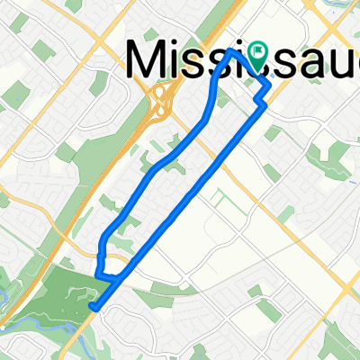
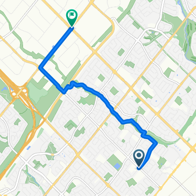
A nice recreational loop in Erin Mills. Uphill to start and downhill to finish. Take in a clockwise fashion with the south half of the loop first to enjoy the creek going downhill. Entirely on trails. The Erin Mills Parkway Crossings are below grade trail tunnels. Some secondary street level crossings. The residential portion of the route is paved trail and the creek portion is a dirt trail.
You can bring your bikes by car to Erindale Park and park in the car lot there. A pedestrian bridge crosses the Credit River -- it can be ridden across by bike when pedestrian traffic is light. The Sawmill Creek portion is beautiful. The creek trail can be wet in the spring and after a good rainfall.
Two hills at the beginning of route may require dismounting for the most casual riders to ascend the incline.
Riders wishing to extend their ride can do so along the Credit River by way of the Culham Trail which meets the Erindale Park carlot.
created this 9 years ago


Route quality
Cycleway
7.2 km
(72 %)
Path
2.4 km
(24 %)
Paved
3.3 km
(33 %)
Unpaved
0.2 km
(2 %)
Asphalt
3.2 km
(32 %)
Ground
0.2 km
(2 %)
Continue with Bikemap
You would like to ride Sawmill Creek, Mississauga Loop - 10k or customize it for your own trip? Here is what you can do with this Bikemap route:
Free trial for 3 days, or one-time payment. More about Bikemap Premium.
Discover more Premium features.
Get Bikemap PremiumFrom our community
Open it in the app