

Karlshöhe
A cycling route starting in Höchberg, Bavaria, Germany.
Overview
About this route
Karlshöhe ca. 82 km 870 hm
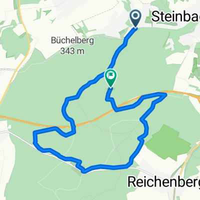
über Mar, Hafehlohr, Karlshöhe, zurück über Greußenheim, Hettstadt
Öffnungszeiten
Mittwoch - Sonntag: 11:00 - 18:00 Uhr
Montag & Dienstag Ruhetag
Wir machen Ferien vom 11. bis 22 April. Ab 23. April sind wir wieder für Sie da.
- -:--
- Duration
- 81.7 km
- Distance
- 682 m
- Ascent
- 686 m
- Descent
- ---
- Avg. speed
- ---
- Max. altitude
Route quality
Waytypes & surfaces along the route
Waytypes
Track
44.1 km
(54 %)
Quiet road
15.5 km
(19 %)
Surfaces
Paved
44.9 km
(55 %)
Unpaved
23.7 km
(29 %)
Asphalt
39.2 km
(48 %)
Gravel
22 km
(27 %)
Route highlights
Points of interest along the route
Point of interest after 40 km
Karlhöhe 455 hm Öffnungszeiten Mittwoch - Sonntag: 11:00 - 18:00 Uhr Montag & Dienstag Ruhetag Wir machen Ferien vom 11. bis 22 April. Ab 23. April sind wir wieder für Sie da.
Continue with Bikemap
Use, edit, or download this cycling route
You would like to ride Karlshöhe or customize it for your own trip? Here is what you can do with this Bikemap route:
Free features
- Save this route as favorite or in collections
- Copy & plan your own version of this route
- Split it into stages to create a multi-day tour
- Sync your route with Garmin or Wahoo
Premium features
Free trial for 3 days, or one-time payment. More about Bikemap Premium.
- Navigate this route on iOS & Android
- Export a GPX / KML file of this route
- Create your custom printout (try it for free)
- Download this route for offline navigation
Discover more Premium features.
Get Bikemap PremiumFrom our community
Other popular routes starting in Höchberg
 Timmy´s Trailorgie Teil 1
- Distance
- 13.7 km
- Ascent
- 257 m
- Descent
- 138 m
- Location
- Höchberg, Bavaria, Germany
 1-Romantische Strasse-Hohenpeißenberg
- Distance
- 364.6 km
- Ascent
- 1,013 m
- Descent
- 556 m
- Location
- Höchberg, Bavaria, Germany
 Kripo Radtour 2014 - 1. Tag
- Distance
- 51.2 km
- Ascent
- 179 m
- Descent
- 166 m
- Location
- Höchberg, Bavaria, Germany
 Lange Runde
- Distance
- 111.9 km
- Ascent
- 538 m
- Descent
- 520 m
- Location
- Höchberg, Bavaria, Germany
 Würzburg-Aschaffenburg, Mainradweg
- Distance
- 131.2 km
- Ascent
- 328 m
- Descent
- 406 m
- Location
- Höchberg, Bavaria, Germany
 Nürnberg - Koblenz Etappe 6/13
- Distance
- 43.5 km
- Ascent
- 56 m
- Descent
- 64 m
- Location
- Höchberg, Bavaria, Germany
 2016 - 2. Tag
- Distance
- 98.3 km
- Ascent
- 217 m
- Descent
- 360 m
- Location
- Höchberg, Bavaria, Germany
 Schwanberg
- Distance
- 81.3 km
- Ascent
- 597 m
- Descent
- 592 m
- Location
- Höchberg, Bavaria, Germany
Open it in the app