

1. Mai 2016
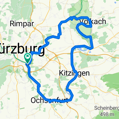
A cycling route starting in Randersacker, Bavaria, Germany.
Overview
About this route
<p>Bike tour May 1, 2016</p>
<p>via Lengfeld to Einsiedel, return via Güntersleben and Wü</p>
Translated, show original (German)- -:--
- Duration
- 57 km
- Distance
- 370 m
- Ascent
- 372 m
- Descent
- ---
- Avg. speed
- ---
- Max. altitude
Route quality
Waytypes & surfaces along the route
Waytypes
Track
19.4 km
(34 %)
Quiet road
12.5 km
(22 %)
Surfaces
Paved
44.5 km
(78 %)
Unpaved
9.7 km
(17 %)
Asphalt
42.2 km
(74 %)
Gravel
5.1 km
(9 %)
Continue with Bikemap
Use, edit, or download this cycling route
You would like to ride 1. Mai 2016 or customize it for your own trip? Here is what you can do with this Bikemap route:
Free features
- Save this route as favorite or in collections
- Copy & plan your own version of this route
- Sync your route with Garmin or Wahoo
Premium features
Free trial for 3 days, or one-time payment. More about Bikemap Premium.
- Navigate this route on iOS & Android
- Export a GPX / KML file of this route
- Create your custom printout (try it for free)
- Download this route for offline navigation
Discover more Premium features.
Get Bikemap PremiumFrom our community
Other popular routes starting in Randersacker
 R_Wü_Ochsengrund
- Distance
- 59.5 km
- Ascent
- 367 m
- Descent
- 367 m
- Location
- Randersacker, Bavaria, Germany
 Ostwind
- Distance
- 88.1 km
- Ascent
- 402 m
- Descent
- 402 m
- Location
- Randersacker, Bavaria, Germany
 Sonntagsausflug 11.07.21
- Distance
- 100.7 km
- Ascent
- 299 m
- Descent
- 299 m
- Location
- Randersacker, Bavaria, Germany
 Mainradtour 2013 Fünfte Etappe
- Distance
- 55.5 km
- Ascent
- 85 m
- Descent
- 72 m
- Location
- Randersacker, Bavaria, Germany
 Berner Straße 23, Würzburg nach St2312, Bischbrunn
- Distance
- 49.7 km
- Ascent
- 946 m
- Descent
- 865 m
- Location
- Randersacker, Bavaria, Germany
 H'hof-Ochsenfurt-Acholshausen-Fuchsstadt-H'hof
- Distance
- 33.3 km
- Ascent
- 256 m
- Descent
- 255 m
- Location
- Randersacker, Bavaria, Germany
 Radtour 2019 - Version
- Distance
- 91.8 km
- Ascent
- 156 m
- Descent
- 159 m
- Location
- Randersacker, Bavaria, Germany
 Route in Würzburg
- Distance
- 62.4 km
- Ascent
- 575 m
- Descent
- 574 m
- Location
- Randersacker, Bavaria, Germany
Open it in the app