
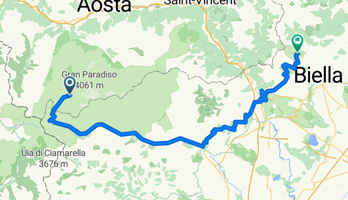
U96 2016 Etappe 6: Valsavarenche - Biella
A cycling route starting in Valsavarenche, Aosta Valley, Italy.
Overview
About this route
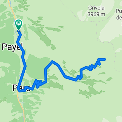
Valsavarenche - Colle del Nivolet - Croce Serra - Galleria Rosazza
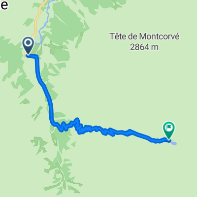
km 0 bis 1: Rad tragen (ca. 300 Höhenmeter)
km 1 bis 2: Rad schieben / tragen
km 2 bis 6: Wiese/ gröstenteils fahrbar mit CX Rad
Gesamt: 2h von Pont bis Colle del Nivolet
geschottert zwischen km 101,5 und 103,5, mit Rennrad gut fahrbar
- -:--
- Duration
- 135.6 km
- Distance
- 2,278 m
- Ascent
- 3,114 m
- Descent
- ---
- Avg. speed
- ---
- Max. altitude
Continue with Bikemap
Use, edit, or download this cycling route
You would like to ride U96 2016 Etappe 6: Valsavarenche - Biella or customize it for your own trip? Here is what you can do with this Bikemap route:
Free features
- Save this route as favorite or in collections
- Copy & plan your own version of this route
- Split it into stages to create a multi-day tour
- Sync your route with Garmin or Wahoo
Premium features
Free trial for 3 days, or one-time payment. More about Bikemap Premium.
- Navigate this route on iOS & Android
- Export a GPX / KML file of this route
- Create your custom printout (try it for free)
- Download this route for offline navigation
Discover more Premium features.
Get Bikemap PremiumFrom our community
Other popular routes starting in Valsavarenche
 7-V Emanuele 2
- Distance
- 4.7 km
- Ascent
- 770 m
- Descent
- 17 m
- Location
- Valsavarenche, Aosta Valley, Italy
 U96 2015 CX Alpentour Piemont - Etappe 2: Val Savarenche - Viù
- Distance
- 128.9 km
- Ascent
- 2,026 m
- Descent
- 2,415 m
- Location
- Valsavarenche, Aosta Valley, Italy
 AlpenX T4
- Distance
- 48.4 km
- Ascent
- 1,503 m
- Descent
- 2,018 m
- Location
- Valsavarenche, Aosta Valley, Italy
 Pont Valsavaranche - Torino
- Distance
- 161.8 km
- Ascent
- 274 m
- Descent
- 2,015 m
- Location
- Valsavarenche, Aosta Valley, Italy
 3030 con Pippo Tizzy e Lo
- Distance
- 30.5 km
- Ascent
- 1,627 m
- Descent
- 1,626 m
- Location
- Valsavarenche, Aosta Valley, Italy
 Mont Blanc
- Distance
- 159.4 km
- Ascent
- 3,121 m
- Descent
- 4,080 m
- Location
- Valsavarenche, Aosta Valley, Italy
 Da Eaux rousses, Valsavarenche a Eaux rousses, Valsavarenche
- Distance
- 20.2 km
- Ascent
- 1,969 m
- Descent
- 1,934 m
- Location
- Valsavarenche, Aosta Valley, Italy
 6-Plan Borgnoz
- Distance
- 12.4 km
- Ascent
- 770 m
- Descent
- 771 m
- Location
- Valsavarenche, Aosta Valley, Italy
Open it in the app