

Deutschland Süd Nord
- 957.2 km
- 519 m
- 808 m
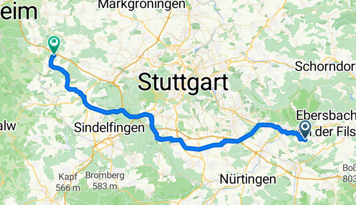
- Hochdorf, Baden-Wurttemberg, Germany
A cycling route starting in Hochdorf, Baden-Wurttemberg, Germany.
Overview
TEASI track
created this 10 years ago
Route quality
Path
11.4 km
18 %
Quiet road
10.8 km
17 %
Paved
55.9 km
(88 %)
Unpaved
3.8 km
(6 %)
Asphalt
54 km
85 %
Paved (undefined)
1.9 km
3 %
Route highlights
Steinbeisstraße, 4
N48°41.939' E9°20.292'
N48°41.539' E9°07.739'
Alemannenstraße, 6
Continue with Bikemap
You would like to ride 20160312_024655.gpx or customize it for your own trip? Here is what you can do with this Bikemap route:
Free trial for 3 days, or one-time payment. More about Bikemap Premium.
Discover more Premium features.
Get Bikemap PremiumFrom our community
Open it in the app


