


_MainRadweg „Roter Main“_
- 486.7 km
- 3,097 m
- 3,382 m
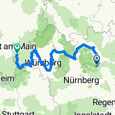
- Pegnitz, Bavaria, Germany
A cycling route starting in Pegnitz, Bavaria, Germany.
Overview
TEASI track
created this 9 years ago
Route quality
Track
25.5 km
(56 %)
Quiet road
7.3 km
(16 %)
Paved
15 km
(33 %)
Unpaved
21.9 km
(48 %)
Asphalt
12.3 km
(27 %)
Gravel
11.9 km
(26 %)
Route highlights
Continue with Bikemap
You would like to ride 20150521_105427.gpx or customize it for your own trip? Here is what you can do with this Bikemap route:
Free trial for 3 days, or one-time payment. More about Bikemap Premium.
Discover more Premium features.
Get Bikemap PremiumFrom our community
Open it in the app


