

KING 2016 bikemap
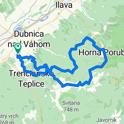
A cycling route starting in Nová Dubnica, Trenčín Region, Slovakia.
Overview
About this route
- -:--
- Duration
- 100.7 km
- Distance
- 2,357 m
- Ascent
- 2,357 m
- Descent
- ---
- Avg. speed
- ---
- Max. altitude

Continue with Bikemap
Use, edit, or download this cycling route
You would like to ride KING 2016 bikemap or customize it for your own trip? Here is what you can do with this Bikemap route:
Free features
- Save this route as favorite or in collections
- Copy & plan your own version of this route
- Split it into stages to create a multi-day tour
- Sync your route with Garmin or Wahoo
Premium features
Free trial for 3 days, or one-time payment. More about Bikemap Premium.
- Navigate this route on iOS & Android
- Export a GPX / KML file of this route
- Create your custom printout (try it for free)
- Download this route for offline navigation
Discover more Premium features.
Get Bikemap PremiumFrom our community
Other popular routes starting in Nová Dubnica
 MTBIKER Novodubnický maratón 26.ročník
- Distance
- 44.8 km
- Ascent
- 1,340 m
- Descent
- 1,344 m
- Location
- Nová Dubnica, Trenčín Region, Slovakia
 CACHTICE,HRACH.,KOSTOLNE,HRASNE,MYJAVA,PAPRAD,ST.TURA,N.MESTO N/V
- Distance
- 147.8 km
- Ascent
- 354 m
- Descent
- 352 m
- Location
- Nová Dubnica, Trenčín Region, Slovakia
 ANTONSTAL,KRASNY DUB,DUBRAVA,VYSKOVEC,KYKULA
- Distance
- 78.2 km
- Ascent
- 939 m
- Descent
- 939 m
- Location
- Nová Dubnica, Trenčín Region, Slovakia
 Gilianka-Vrstac-Sidonie
- Distance
- 47.5 km
- Ascent
- 626 m
- Descent
- 625 m
- Location
- Nová Dubnica, Trenčín Region, Slovakia
 Z02 Na Uhrovsky hrad/Stredna Nitra
- Distance
- 179.9 km
- Ascent
- 1,283 m
- Descent
- 1,363 m
- Location
- Nová Dubnica, Trenčín Region, Slovakia
 Dubnický Marathon
- Distance
- 44.4 km
- Ascent
- 959 m
- Descent
- 963 m
- Location
- Nová Dubnica, Trenčín Region, Slovakia
 Nova Dubnica-Inovec-Nova Dubnica
- Distance
- 75.4 km
- Ascent
- 1,127 m
- Descent
- 1,127 m
- Location
- Nová Dubnica, Trenčín Region, Slovakia
 Kolačín - Trenčianske Teplice
- Distance
- 18.1 km
- Ascent
- 789 m
- Descent
- 833 m
- Location
- Nová Dubnica, Trenčín Region, Slovakia
Open it in the app