

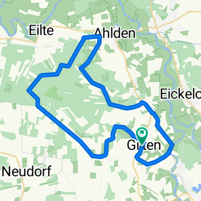
Die Wolfstour (Süd-Route)
A cycling route starting in Gilten, Lower Saxony, Germany.
Overview
About this route
Der Radrundweg (Südroute) durch die Samtgemeinden Heemsen, Steimbke, Rethem und durch den Flecken Ahlden.
- -:--
- Duration
- 59.4 km
- Distance
- 83 m
- Ascent
- 82 m
- Descent
- ---
- Avg. speed
- ---
- Max. altitude
Route quality
Waytypes & surfaces along the route
Waytypes
Track
27.8 km
(47 %)
Road
13.3 km
(22 %)
Surfaces
Paved
43.6 km
(73 %)
Unpaved
13.7 km
(23 %)
Asphalt
41 km
(69 %)
Gravel
11.4 km
(19 %)
Route highlights
Points of interest along the route
Point of interest after 14.2 km
NaturWaldBad Steimbke
Point of interest after 14.3 km
St. Dionysius-Kirche Steimbke
Point of interest after 14.4 km
Kutsch- und Planwagenfahrten Siegfried Häsemeyer
Point of interest after 14.5 km
Hotel Heines Hof
Point of interest after 14.9 km
Hallenbad Steimbke
Point of interest after 20.1 km
Alte Schule Sonnenborstel
Point of interest after 20.2 km
Jägerkrug Sonnenborstel
Point of interest after 24.1 km
Brunsburg
Point of interest after 27.1 km
Gaststätte Lindwedel
Point of interest after 32.3 km
Fachwerkkapelle Anderten
Continue with Bikemap
Use, edit, or download this cycling route
You would like to ride Die Wolfstour (Süd-Route) or customize it for your own trip? Here is what you can do with this Bikemap route:
Free features
- Save this route as favorite or in collections
- Copy & plan your own version of this route
- Sync your route with Garmin or Wahoo
Premium features
Free trial for 3 days, or one-time payment. More about Bikemap Premium.
- Navigate this route on iOS & Android
- Export a GPX / KML file of this route
- Create your custom printout (try it for free)
- Download this route for offline navigation
Discover more Premium features.
Get Bikemap PremiumFrom our community
Other popular routes starting in Gilten
 Roundrip-Gilten1
- Distance
- 26.6 km
- Ascent
- 39 m
- Descent
- 41 m
- Location
- Gilten, Lower Saxony, Germany
 Suderbruch-Norddrebber
- Distance
- 20.9 km
- Ascent
- 9 m
- Descent
- 9 m
- Location
- Gilten, Lower Saxony, Germany
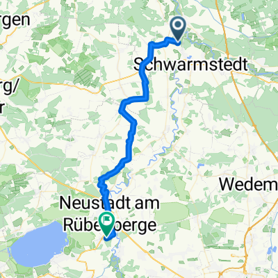
 High-speed route in Schwarmstedt
- Distance
- 33.5 km
- Ascent
- 148 m
- Descent
- 150 m
- Location
- Gilten, Lower Saxony, Germany
 Heidetour_2023v2
- Distance
- 18.9 km
- Ascent
- 73 m
- Descent
- 74 m
- Location
- Gilten, Lower Saxony, Germany
 Bothmer Mühle zurück nach NRü
- Distance
- 38 km
- Ascent
- 68 m
- Descent
- 50 m
- Location
- Gilten, Lower Saxony, Germany
 06:30 Uhr
- Distance
- 40.3 km
- Ascent
- 140 m
- Descent
- 138 m
- Location
- Gilten, Lower Saxony, Germany
 Samstagsrunde
- Distance
- 47.8 km
- Ascent
- 192 m
- Descent
- 190 m
- Location
- Gilten, Lower Saxony, Germany
 Gilten-Essel-RT1
- Distance
- 26.5 km
- Ascent
- 62 m
- Descent
- 62 m
- Location
- Gilten, Lower Saxony, Germany
Open it in the app