- 53 km
- 896 m
- 896 m
- Aouste-sur-Sye, Auvergne-Rhône-Alpes, France
Mirabel et Blacons - Camargue - Mirabel et Blacons
A cycling route starting in Aouste-sur-Sye, Auvergne-Rhône-Alpes, France.
Overview
About this route
A round tour starting at the river Drôme, along the Rhône river, Orange, Valreas, Avignon, Arles, Camargue, Chateauneuf du Pape, Pont Saint Esprit, Viviers, Montelimar, La Voulte, Crest and back to Mirabel et Blacons.
- -:--
- Duration
- 509.8 km
- Distance
- 581 m
- Ascent
- 581 m
- Descent
- ---
- Avg. speed
- ---
- Max. altitude
created this 9 years ago
Route quality
Waytypes & surfaces along the route
Waytypes
Road
193.7 km
(38 %)
Quiet road
117.2 km
(23 %)
Surfaces
Paved
300.8 km
(59 %)
Unpaved
40.8 km
(8 %)
Asphalt
295.7 km
(58 %)
Gravel
30.6 km
(6 %)
Continue with Bikemap
Use, edit, or download this cycling route
You would like to ride Mirabel et Blacons - Camargue - Mirabel et Blacons or customize it for your own trip? Here is what you can do with this Bikemap route:
Free features
- Save this route as favorite or in collections
- Copy & plan your own version of this route
- Split it into stages to create a multi-day tour
- Sync your route with Garmin or Wahoo
Premium features
Free trial for 3 days, or one-time payment. More about Bikemap Premium.
- Navigate this route on iOS & Android
- Export a GPX / KML file of this route
- Create your custom printout (try it for free)
- Download this route for offline navigation
Discover more Premium features.
Get Bikemap PremiumFrom our community
Other popular routes starting in Aouste-sur-Sye
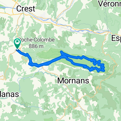
- Boucle à partir de Saou
- Mirabel et Blacons - Camargue - Mirabel et Blacons
- 509.8 km
- 581 m
- 581 m
- Aouste-sur-Sye, Auvergne-Rhône-Alpes, France
- Boucle Saou– Centre historique de Saou au départ de La Répara-Auriples
- 45.8 km
- 1,155 m
- 1,151 m
- Aouste-sur-Sye, Auvergne-Rhône-Alpes, France
- suze - col des limouches et retour
- 46.4 km
- 927 m
- 927 m
- Aouste-sur-Sye, Auvergne-Rhône-Alpes, France
- Col de Rousset + Combe Laval
- 147.7 km
- 2,900 m
- 2,901 m
- Aouste-sur-Sye, Auvergne-Rhône-Alpes, France
- Aouste - Saint-Gervais-sur-Roubion
- 35.1 km
- 443 m
- 513 m
- Aouste-sur-Sye, Auvergne-Rhône-Alpes, France
- Vue sur Saou et les Aiguilles – Saou Runde von Saou
- 33.8 km
- 620 m
- 620 m
- Aouste-sur-Sye, Auvergne-Rhône-Alpes, France
- 21-5-2019 (di ) Rondje in de Franse Vercors
- 39.5 km
- 632 m
- 632 m
- Aouste-sur-Sye, Auvergne-Rhône-Alpes, France
Open it in the app


